
ESE Plot Plan
Open provided drawing
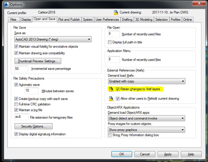
Options
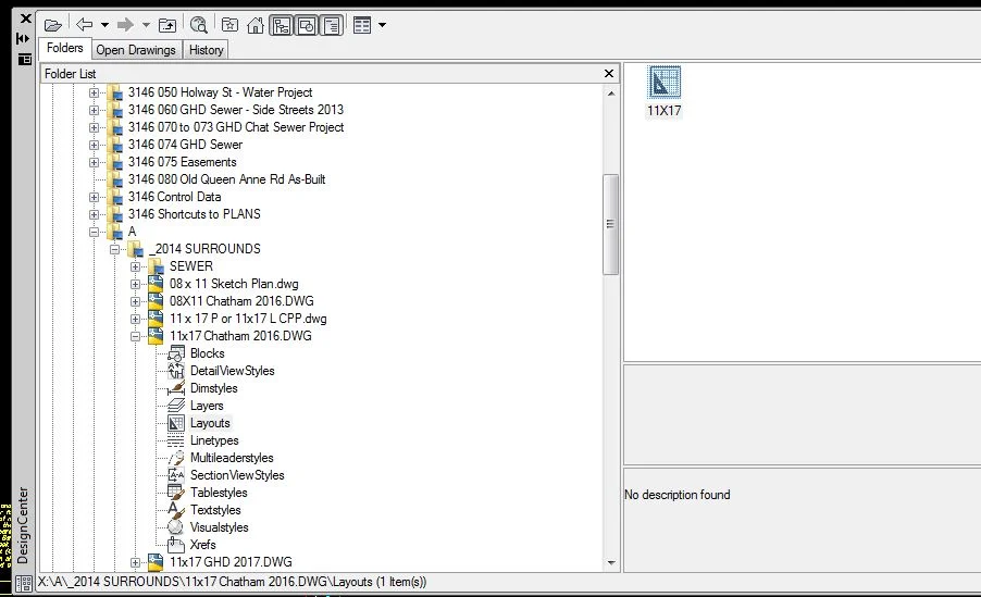
Add 11x17 layout from current surrounds (Control+2)
While in the layout set PSLTSCALE variable to 1
The added layout has a viewport - unlock it
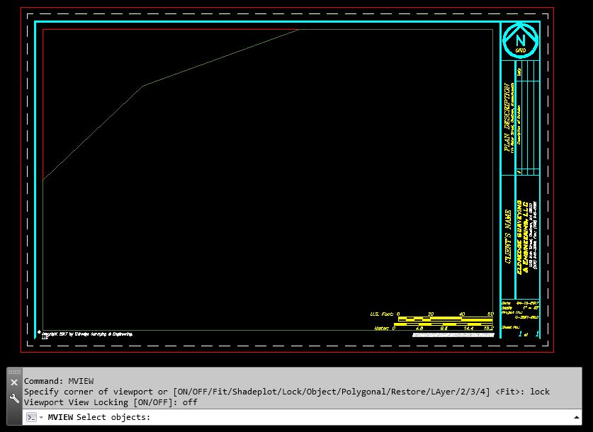
set PSLTSCALE = 1 while in the Layout
copy the viewport - 1 for the Vicinity Map the other for the Plot Plan
in the viewports make sure the desired content is visible
VPSCALE will list the current scale in the selected viewport (this can also be done from the Express
menu - Layout Tools - List Viewport Scale)
Set the viewport scales and lock them
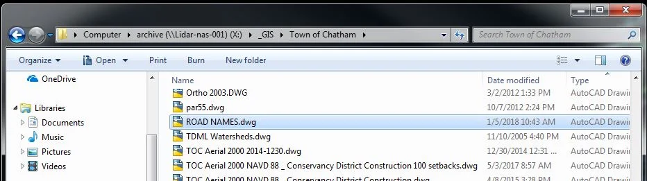
Open ROAD NAMES.dwg
Find the Road Names for the project - Shift+Control+C/Shift+Control+V to add them to the Layout Scale 1/50 then 10/14
Close Road Names - do not save
Open CHAT-ASS.dwg
Shift+Control+C/Shift+Control+V the correct Locus into the Layout
Scale 1/2000
Place on the Layout and Explode the block
Set the active Layer to TEXT_SURROUNDS, locate the property and Hatch it
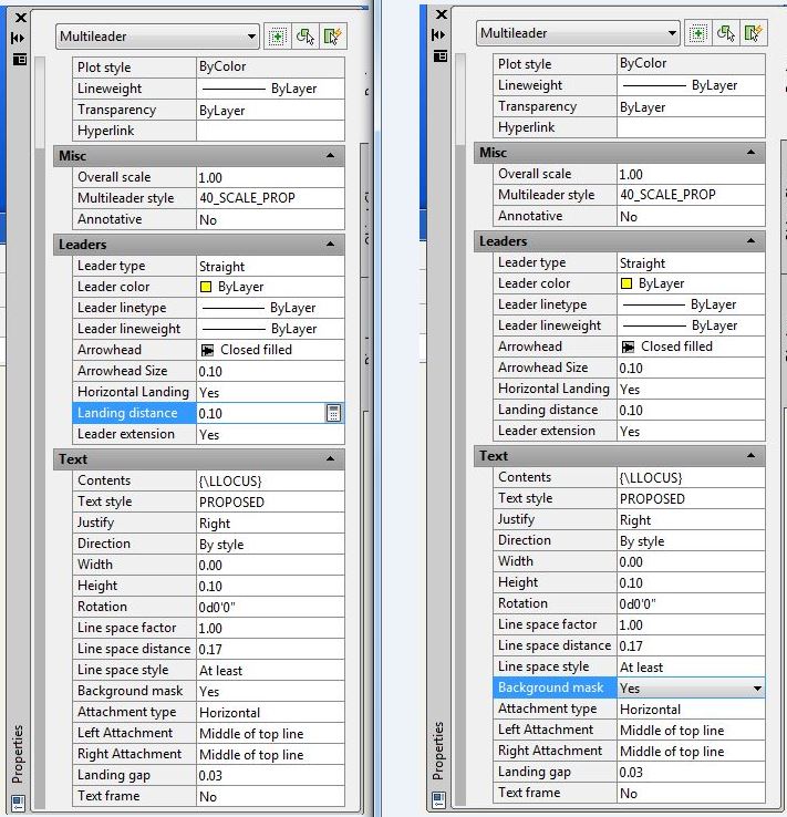
The Locus leader Landing Distance should be 0.10 and Background Mask should be YES
To complete Owner info
go to MapsOnline - locate the property, highlight the Parcel ID and copy it
go back into the drawing and paste it into the text
go to Web_Assessor paste the Parcel ID into the Parcel Id field to get the recent book and page
Open Internet Explorer and search for the Deed to obtain Owner of Record
Edit the surround - Plan Description = Plot Plan - to edit the Date, Project Name, Scale & Page numbers use DDATTE (allows for tab through fields)
While in the layout set PSLTSCALE variable to 1