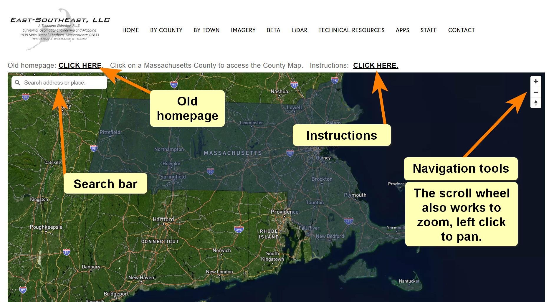
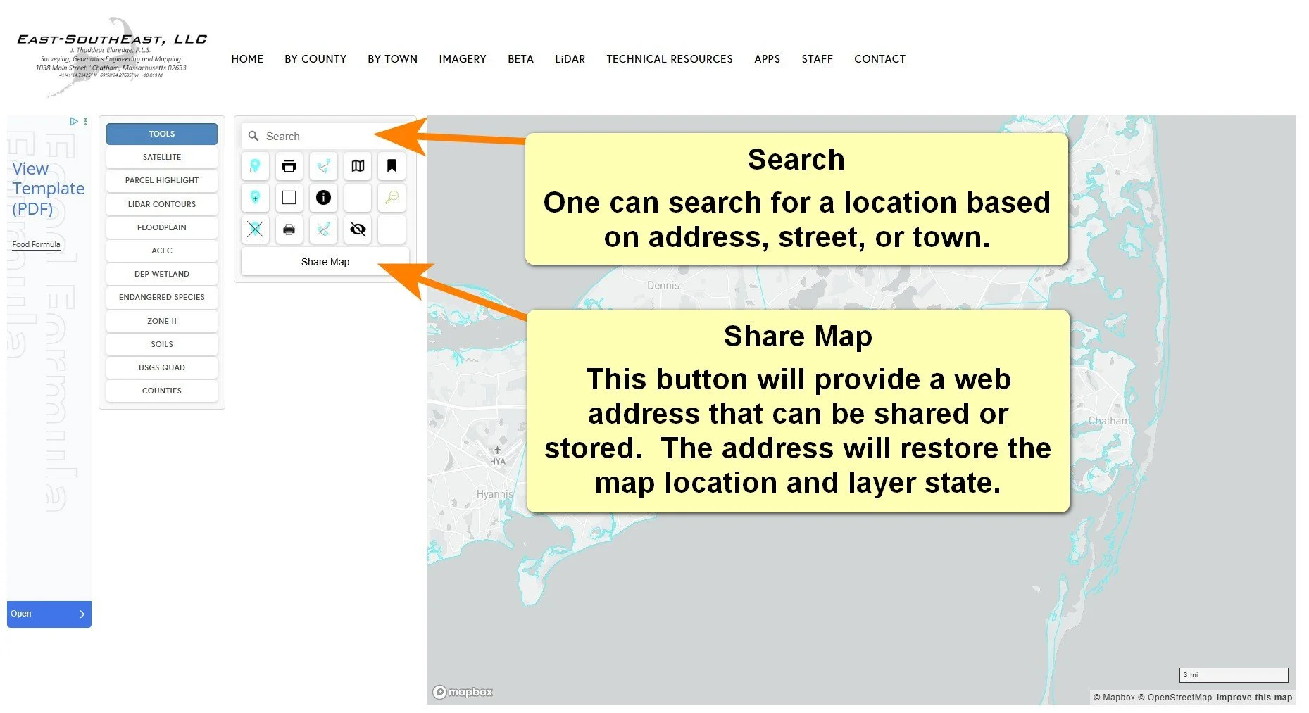
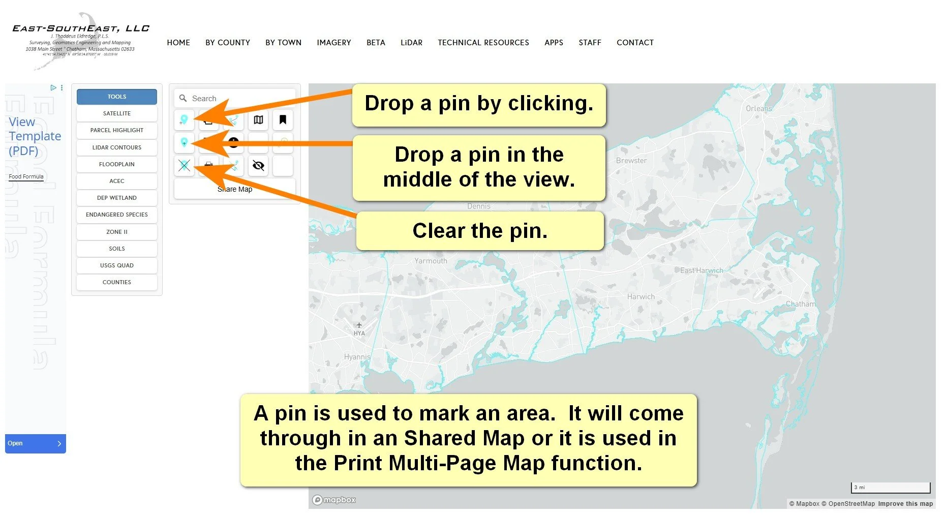
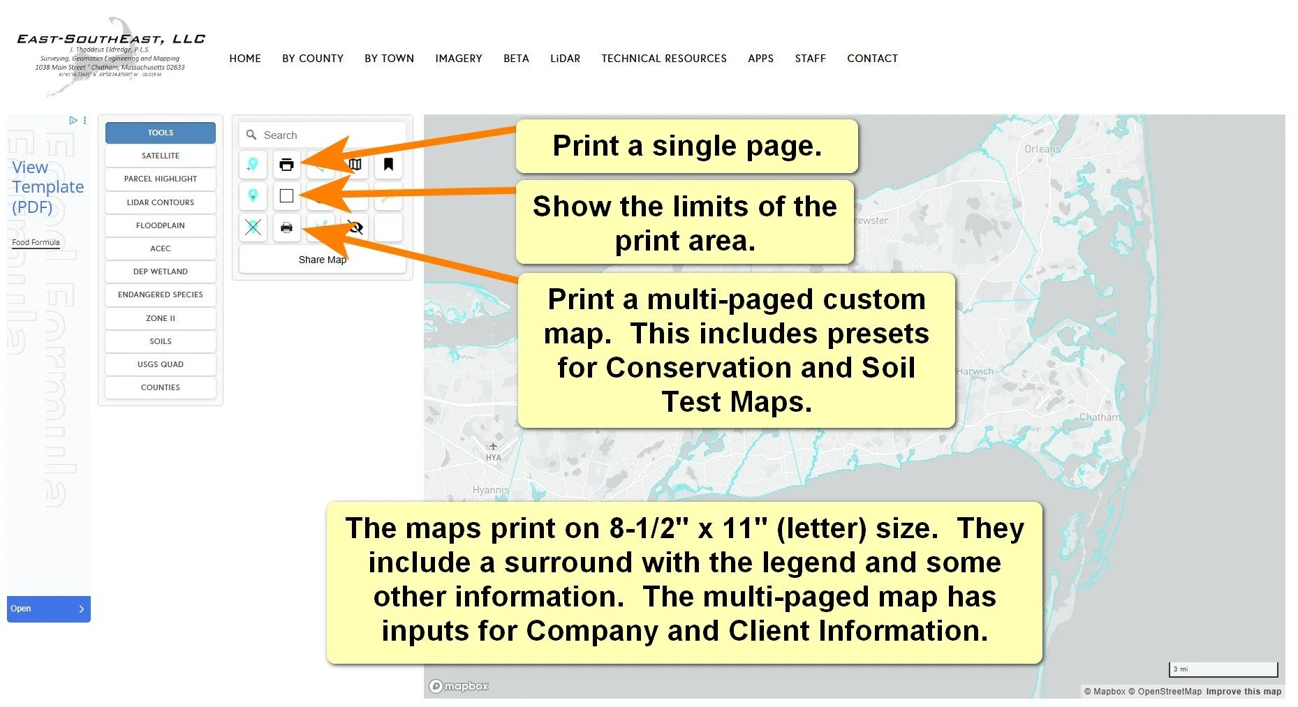
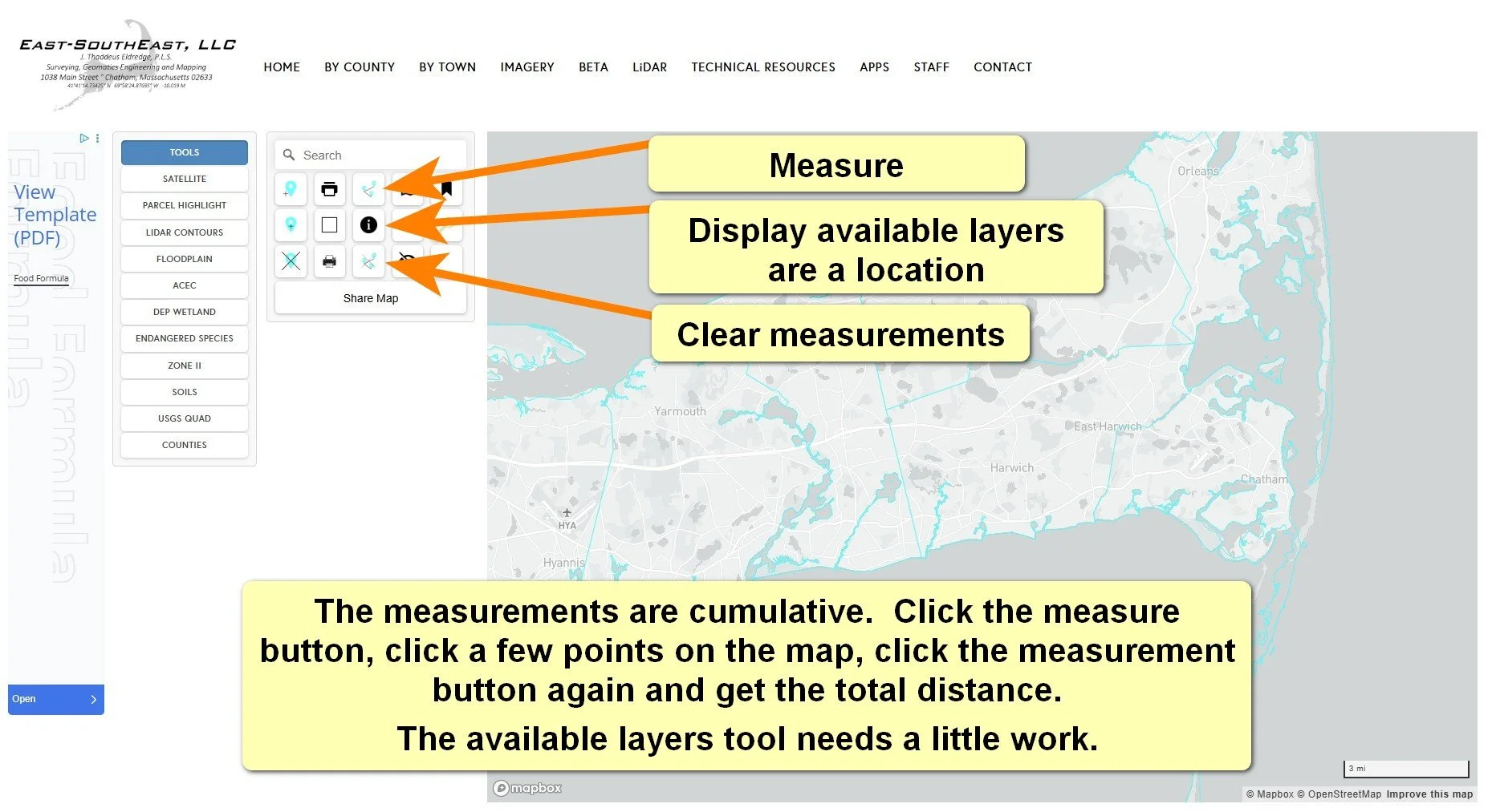
The maps are pretty easy to use. Here are some tutorials to help you get some great results from your experience:
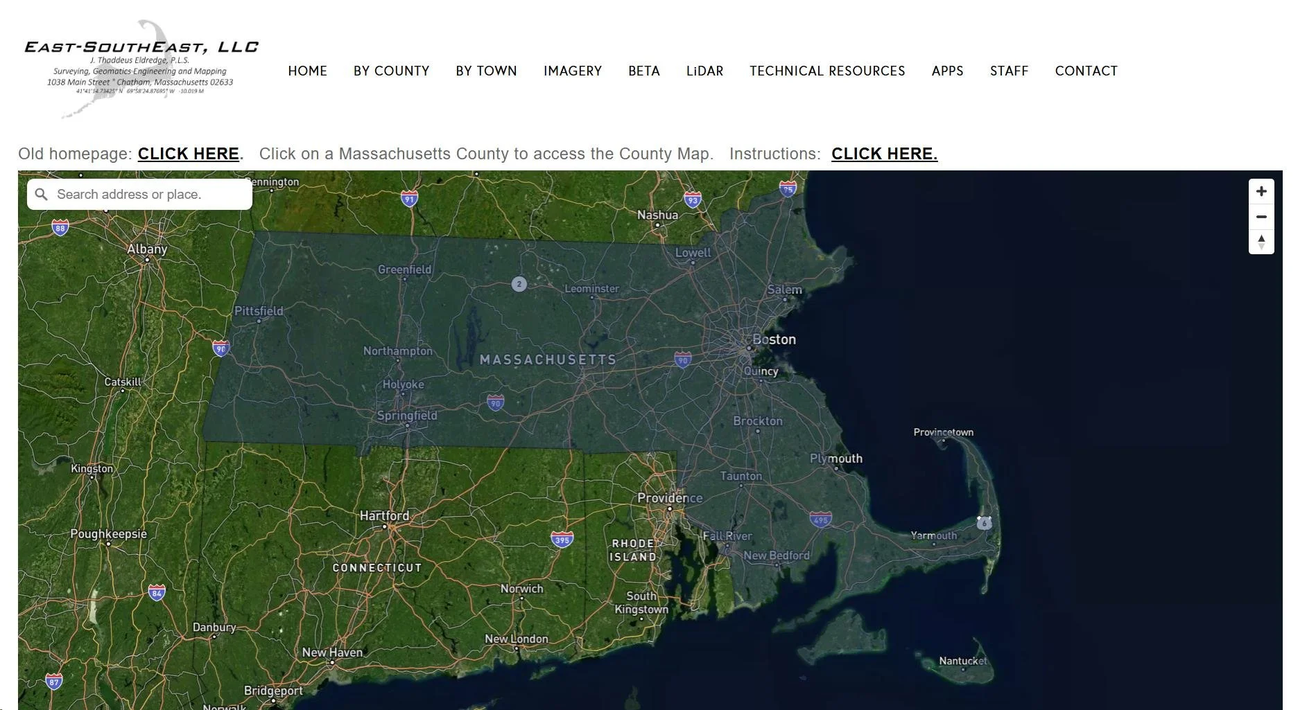
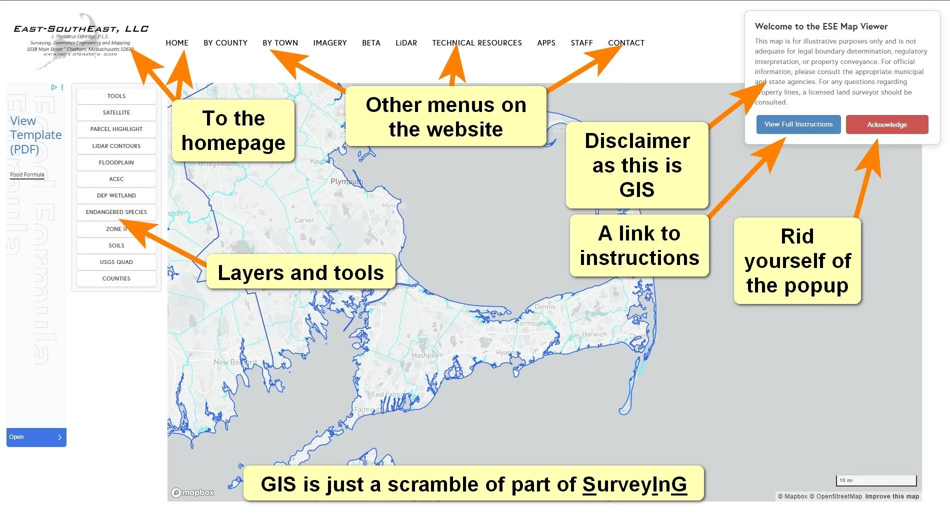
Home Page
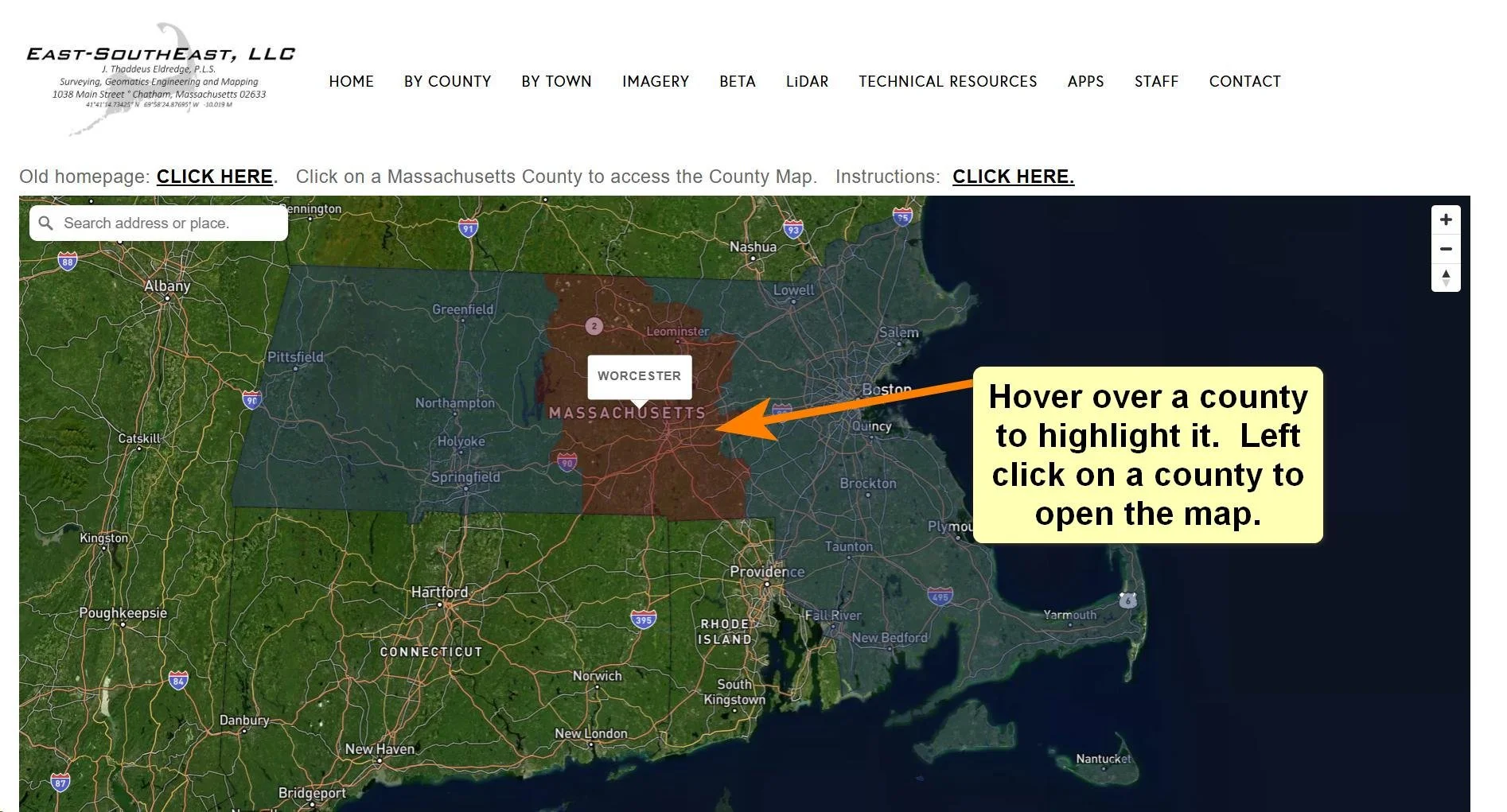
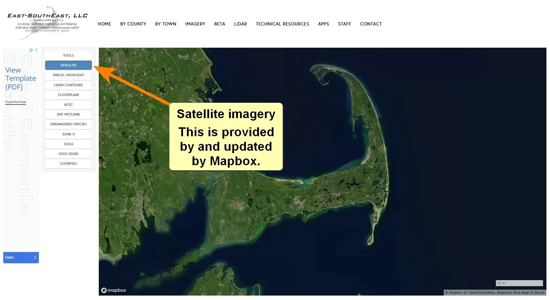
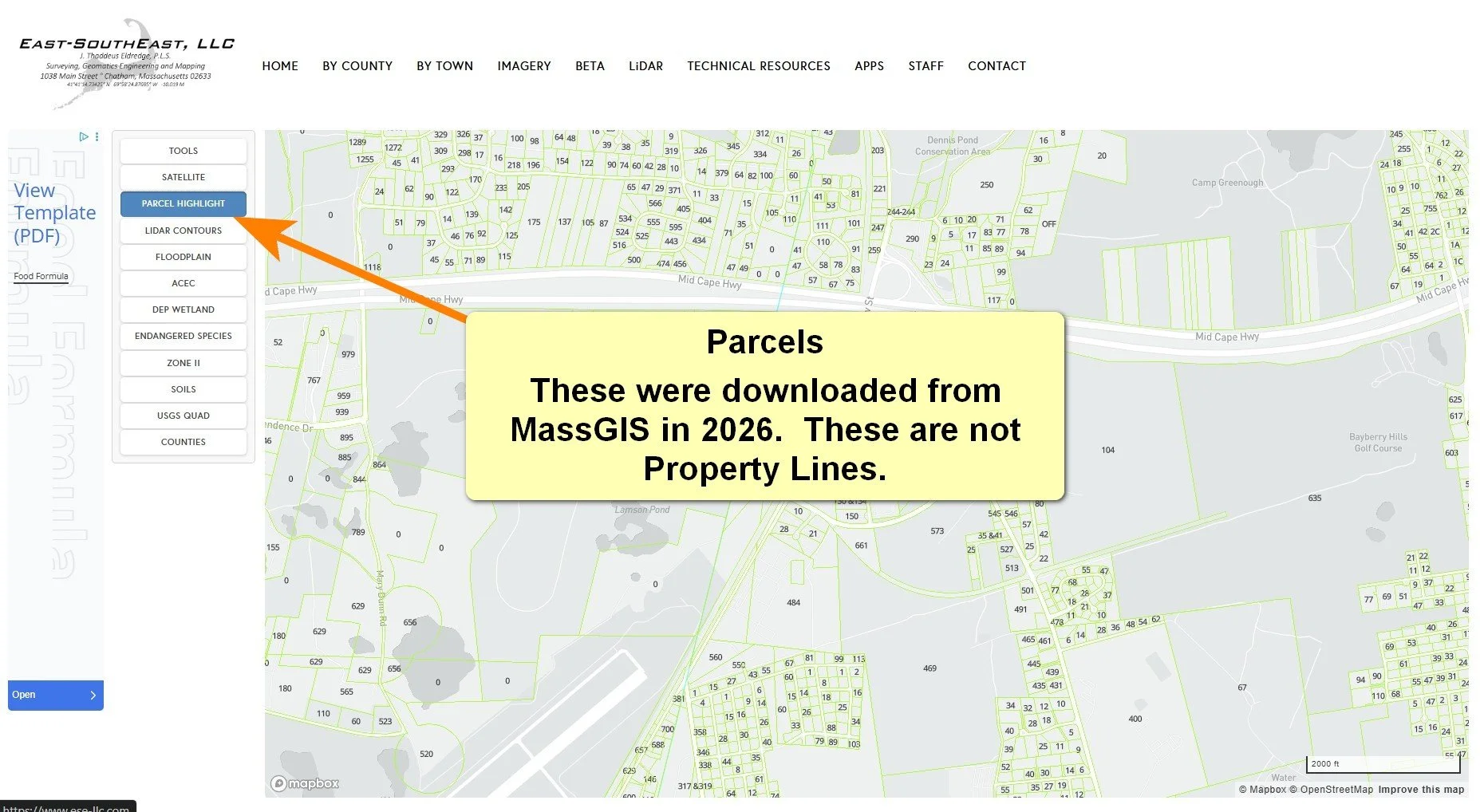
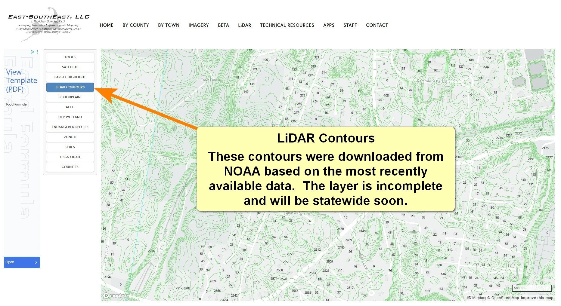
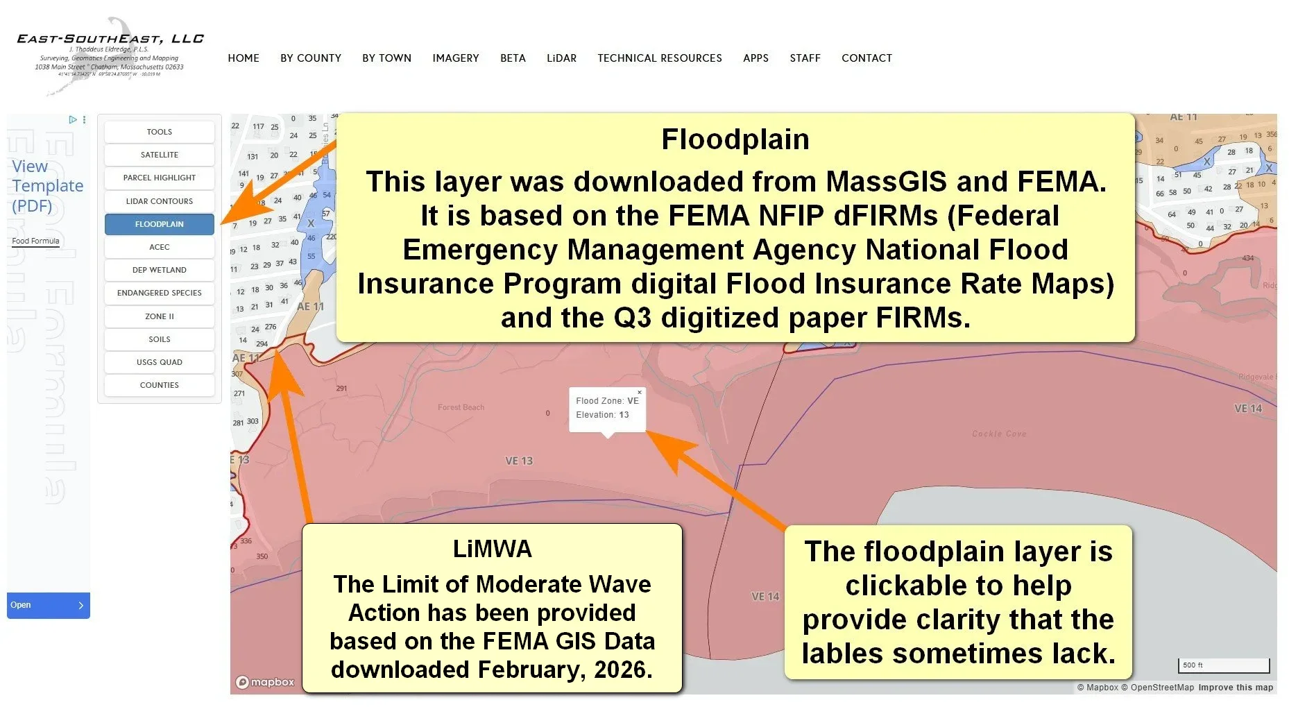
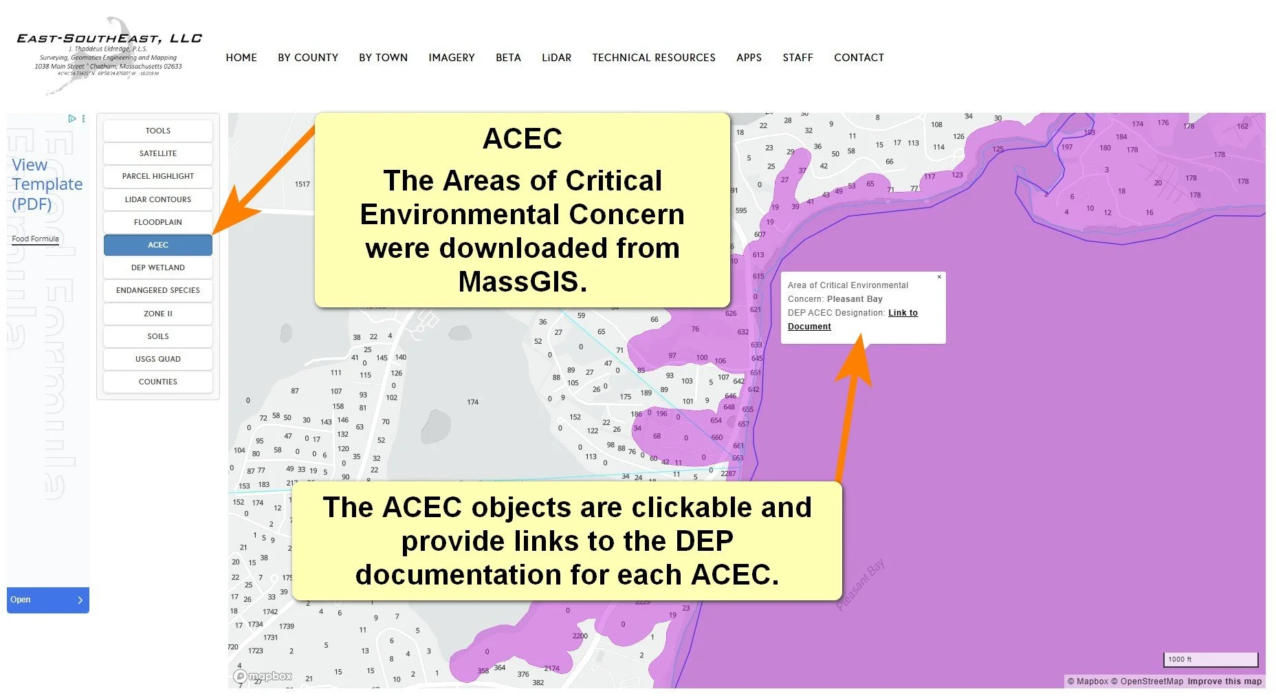
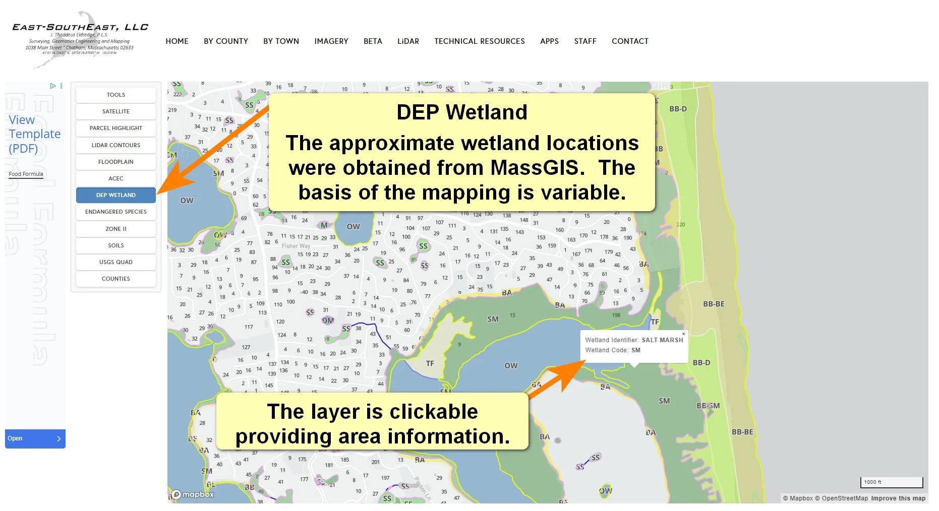
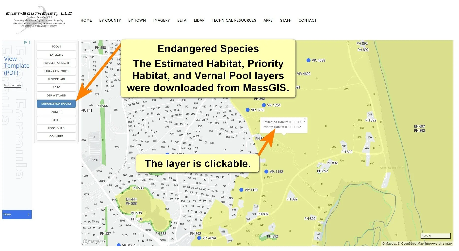
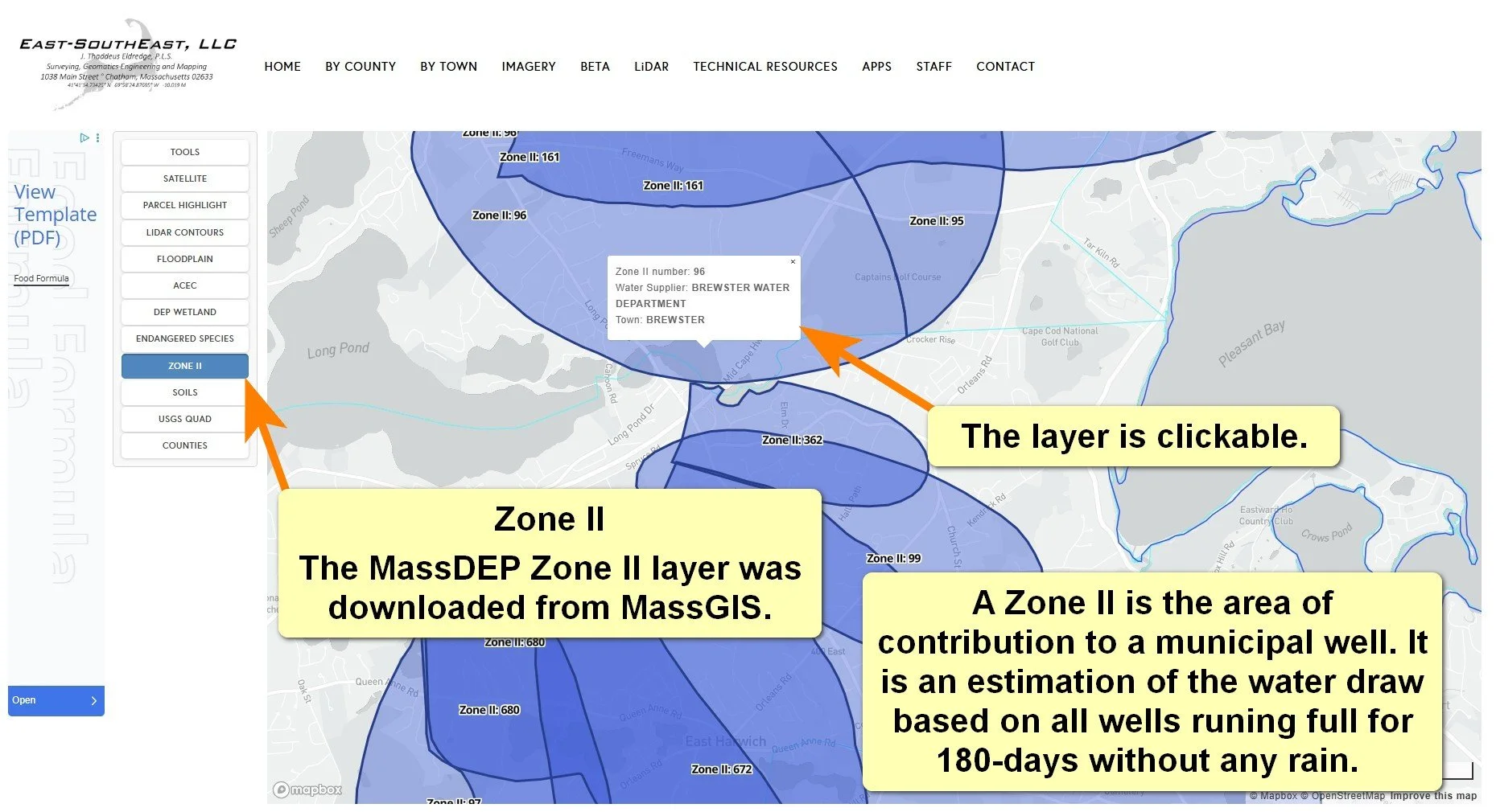
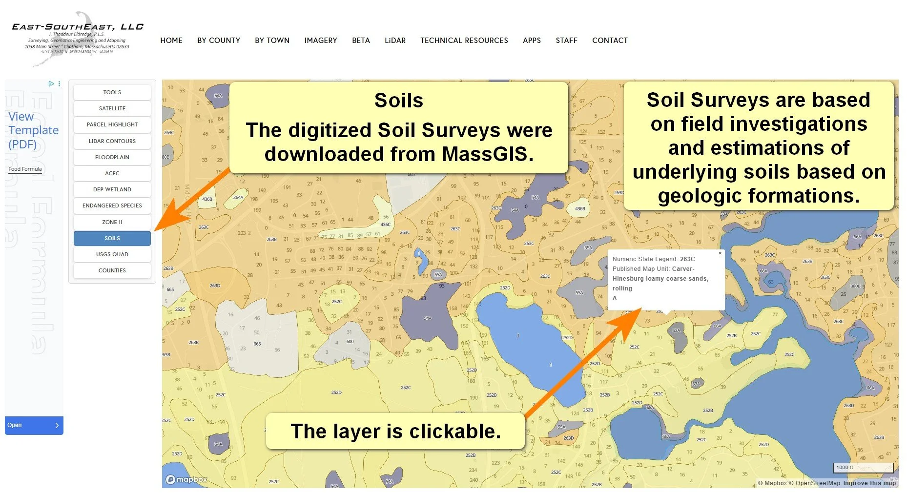
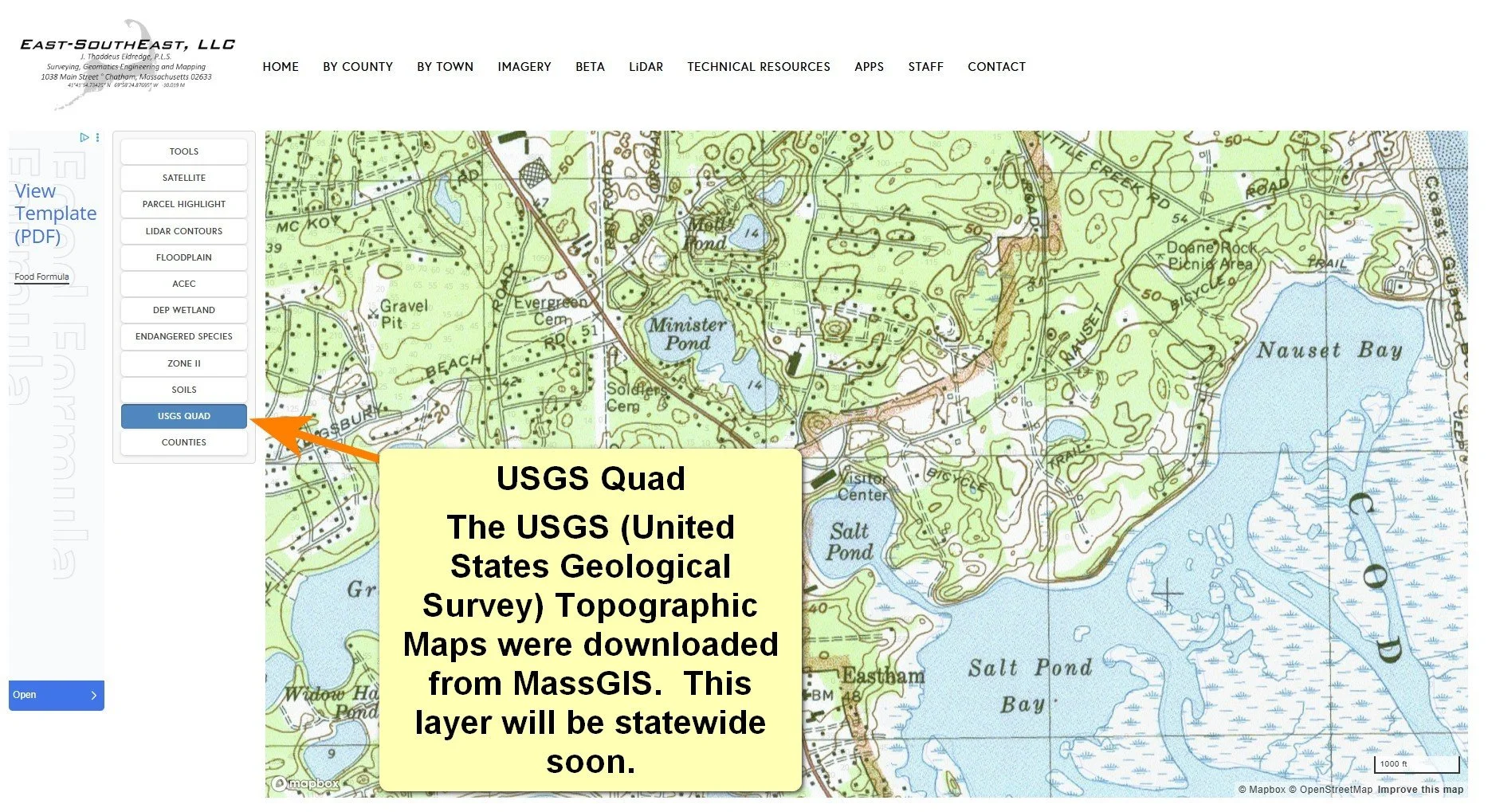
County Maps - Layers
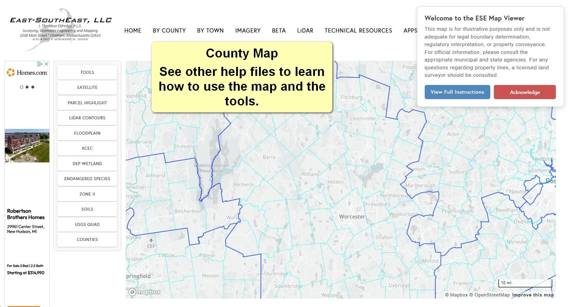
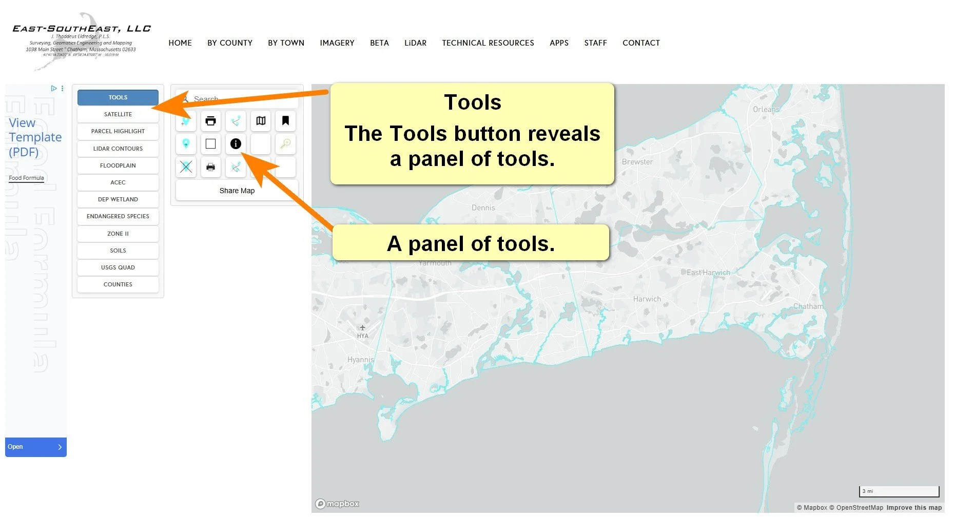
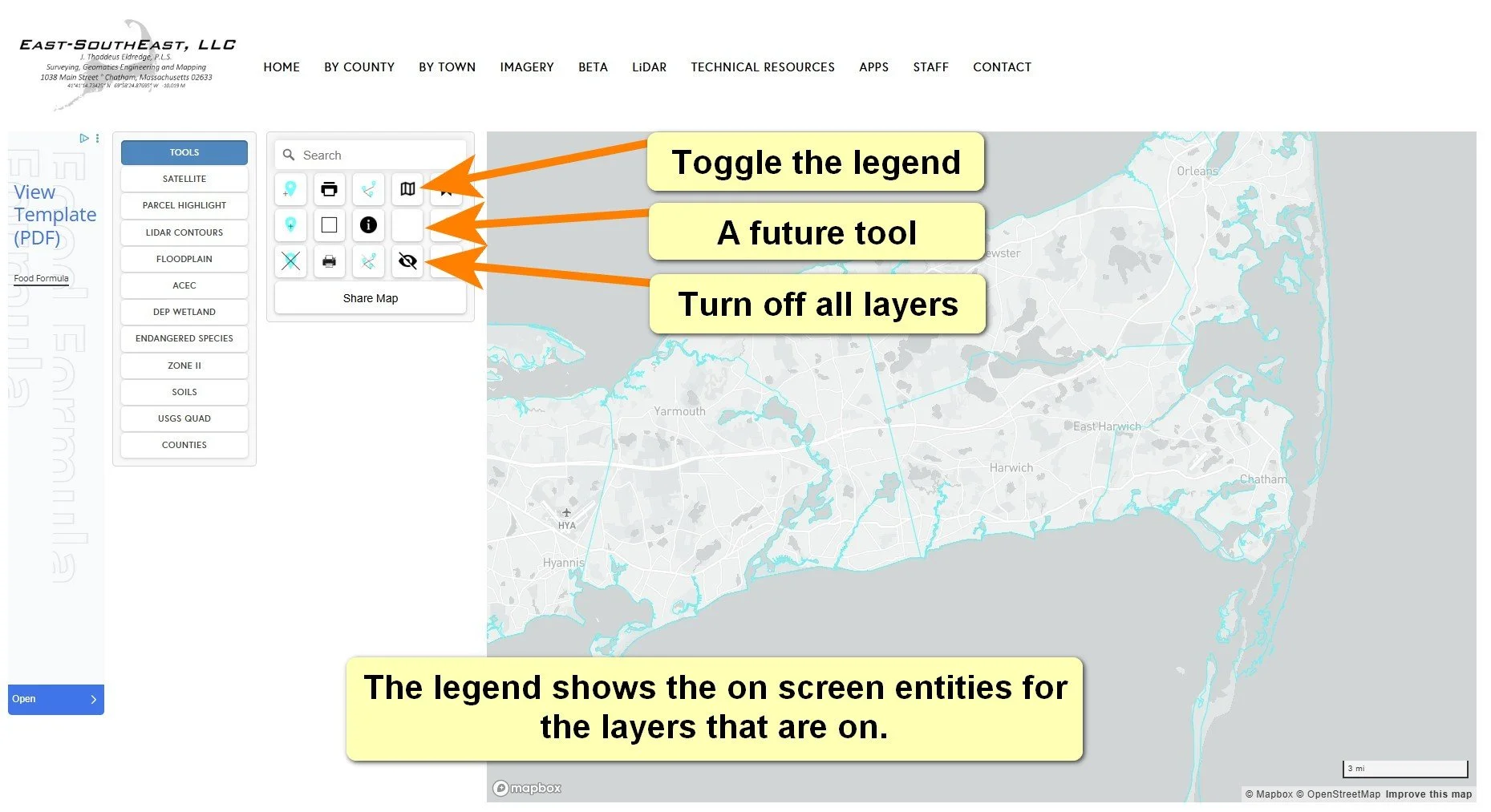
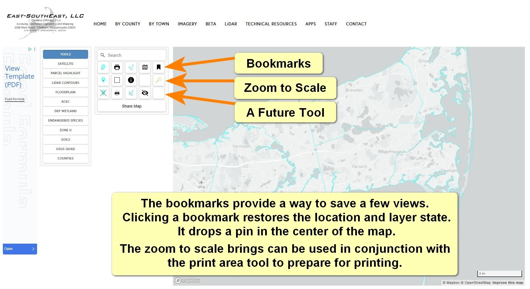
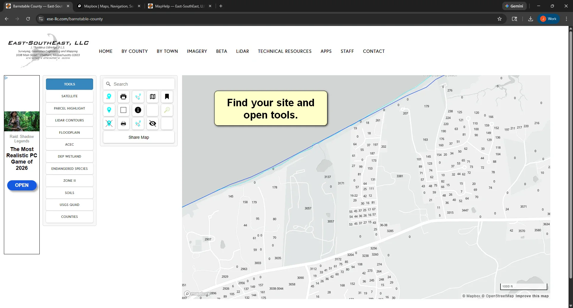
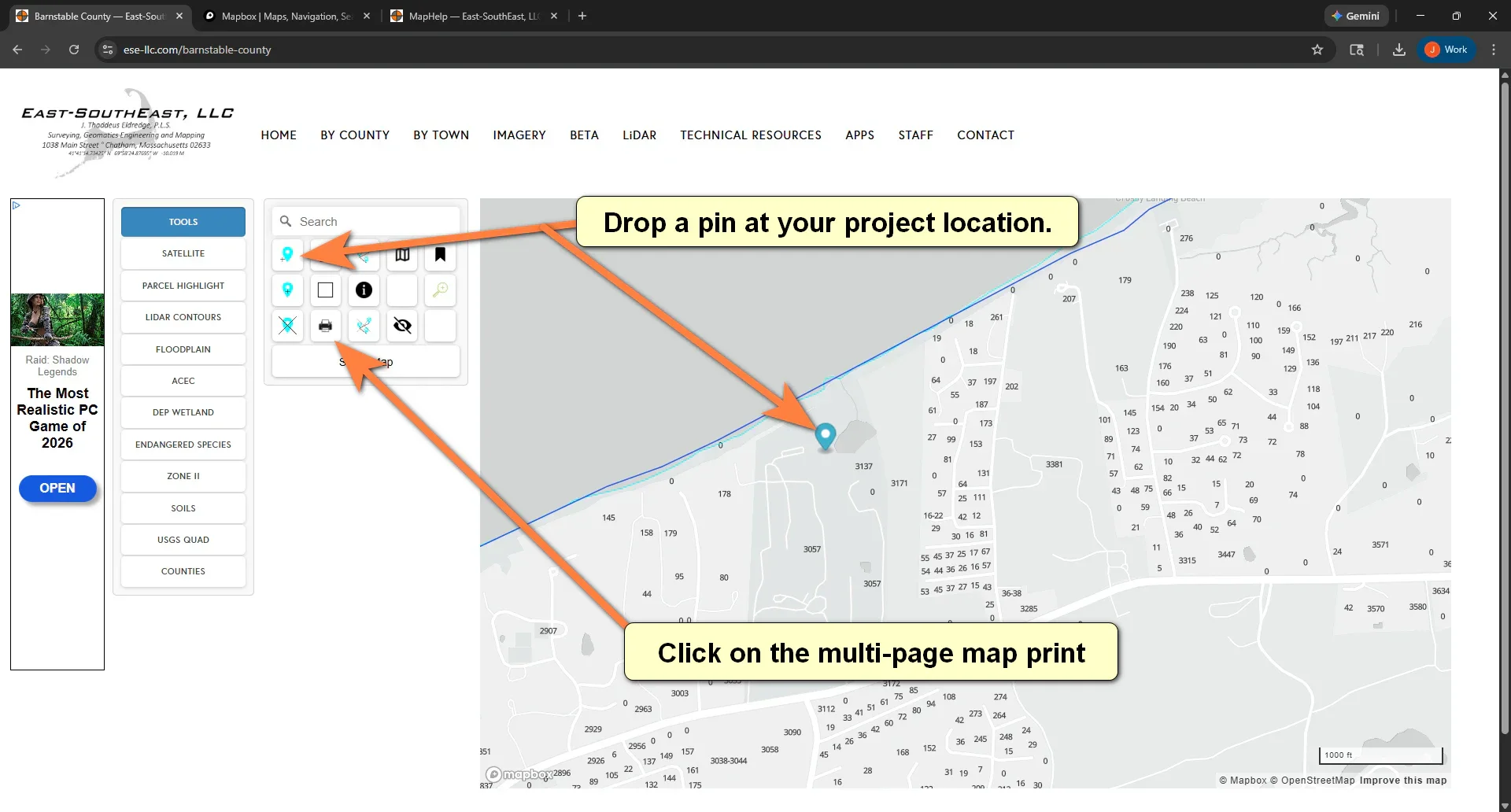
County Maps - Tools
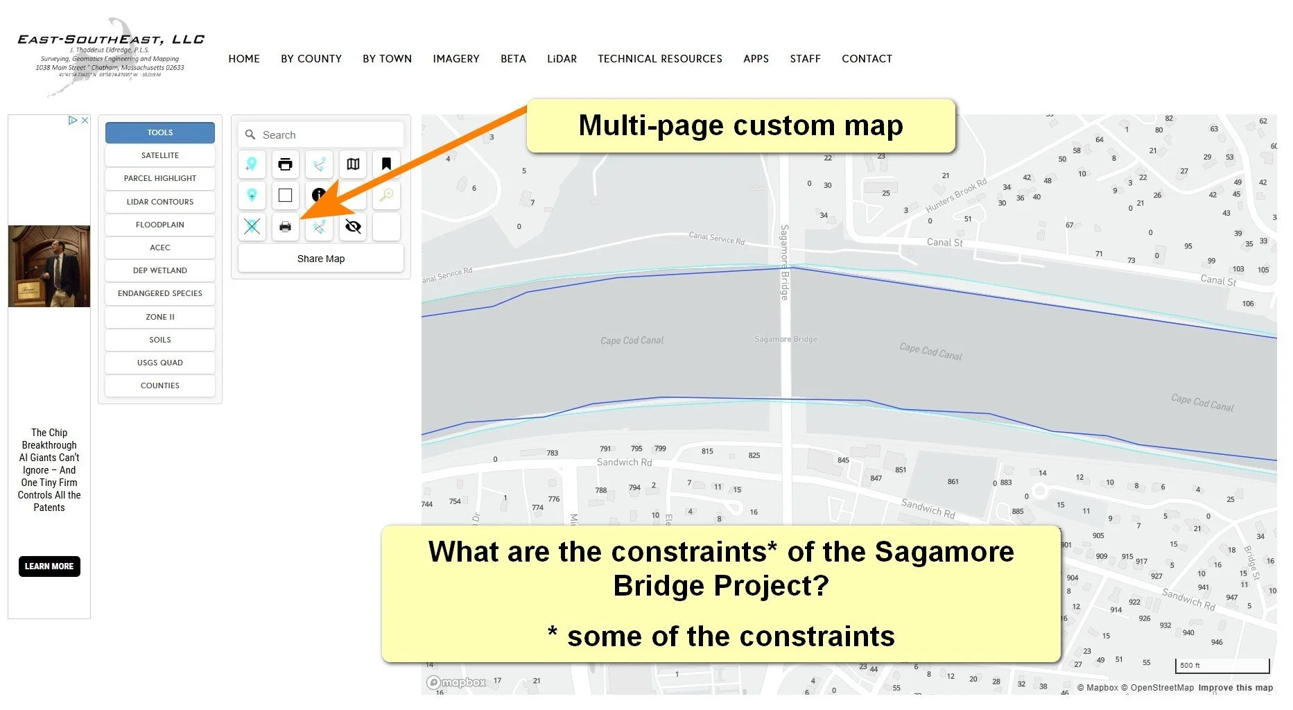
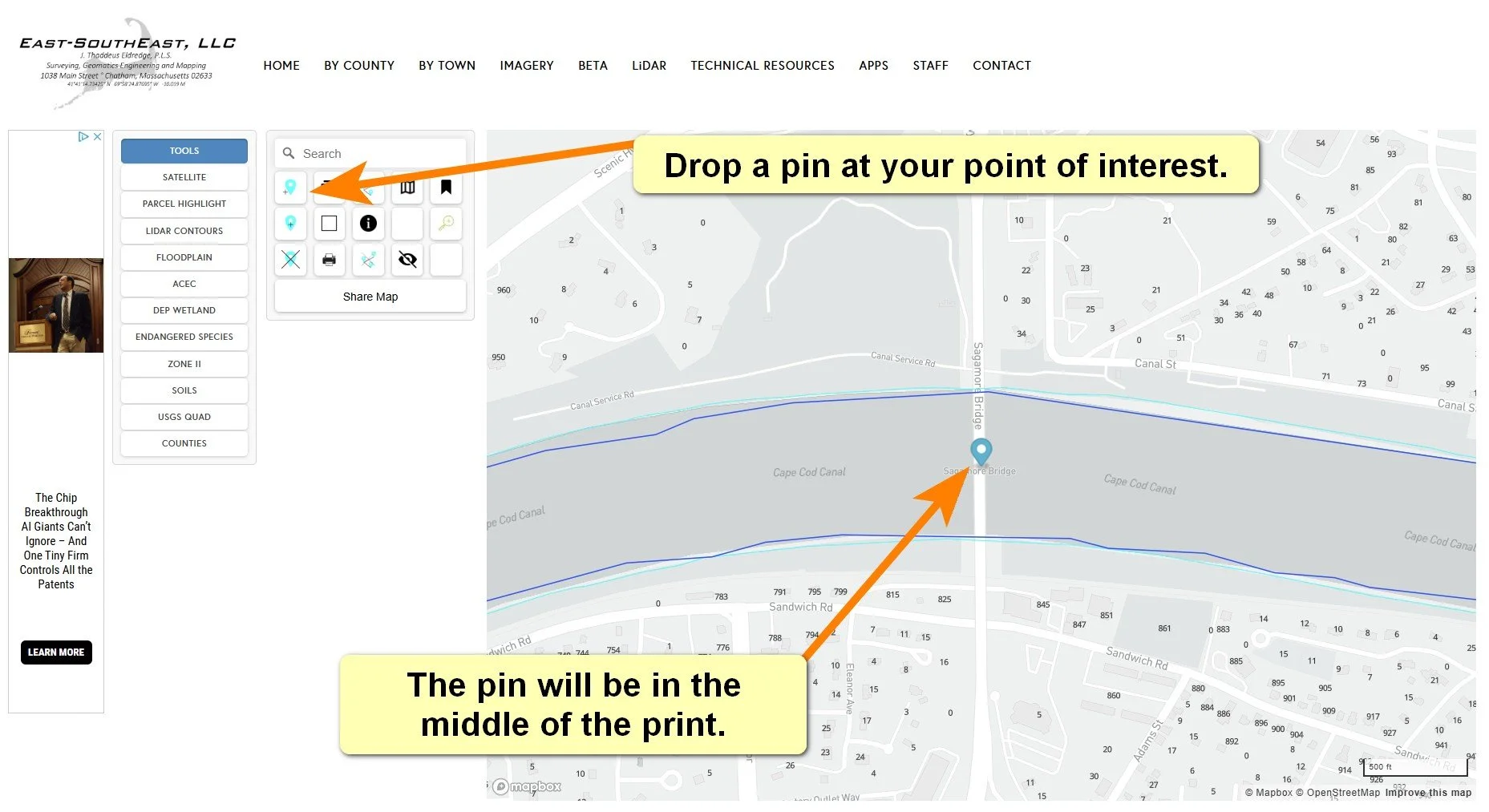
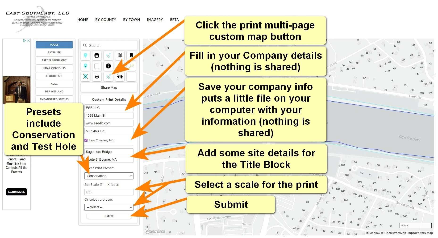
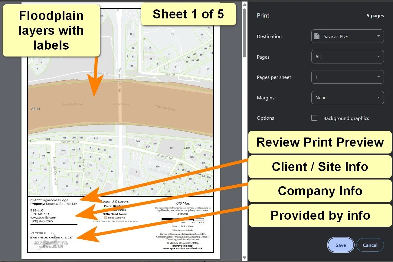
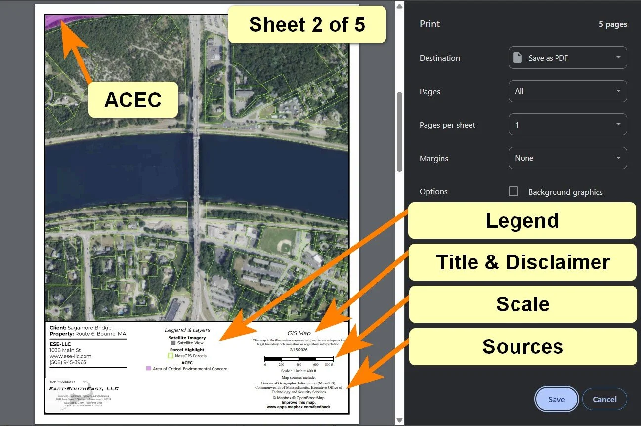
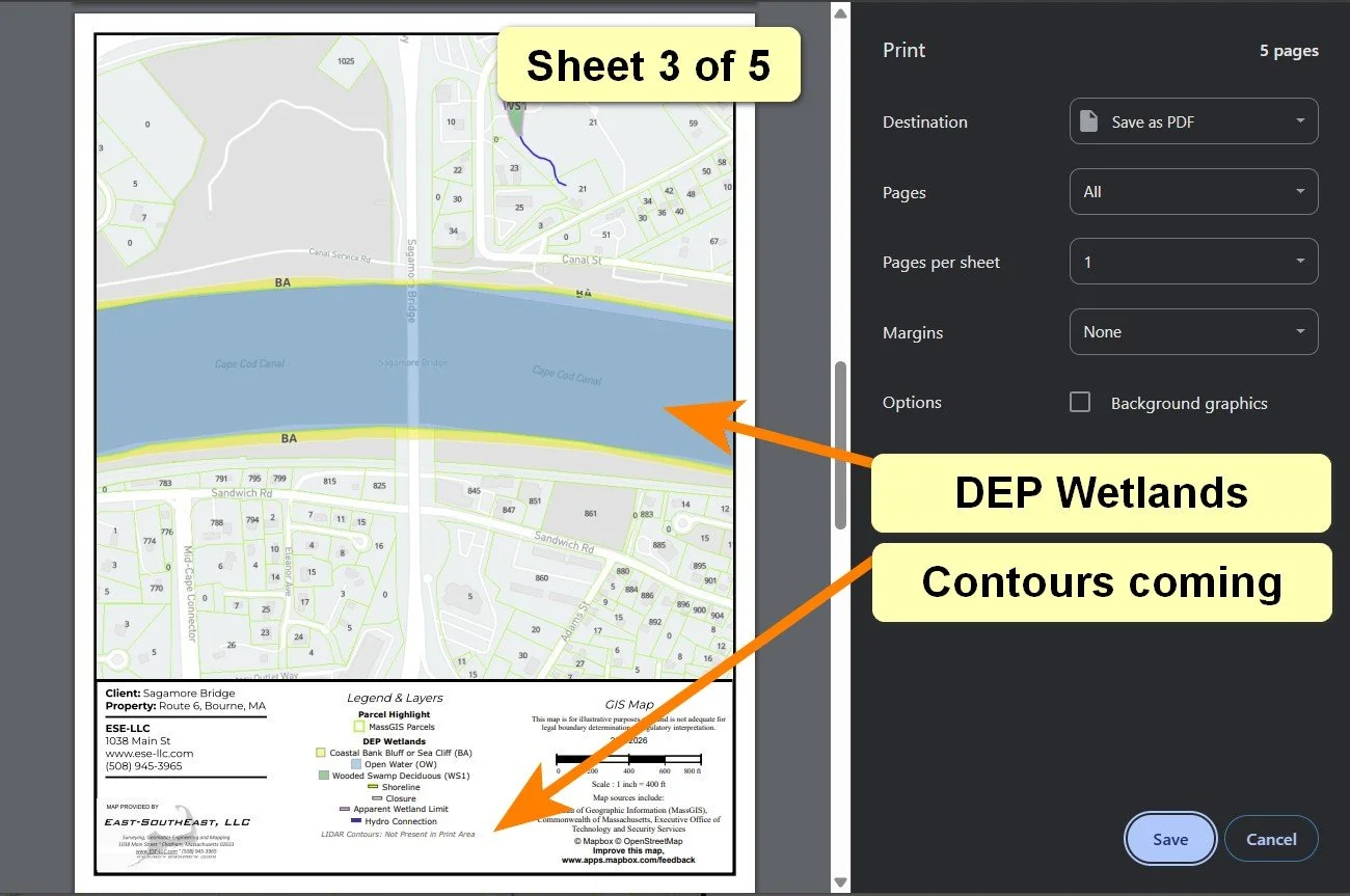
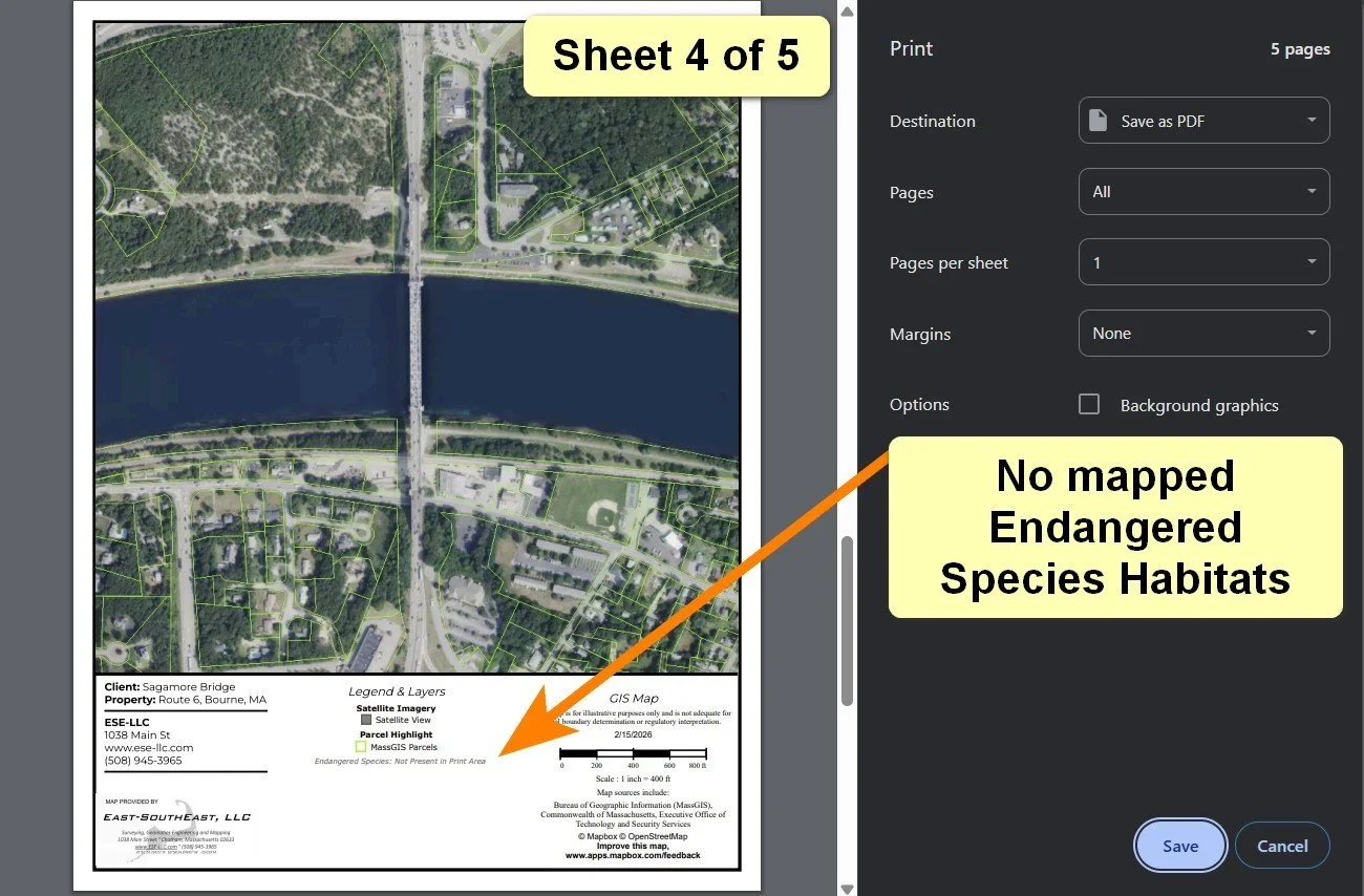
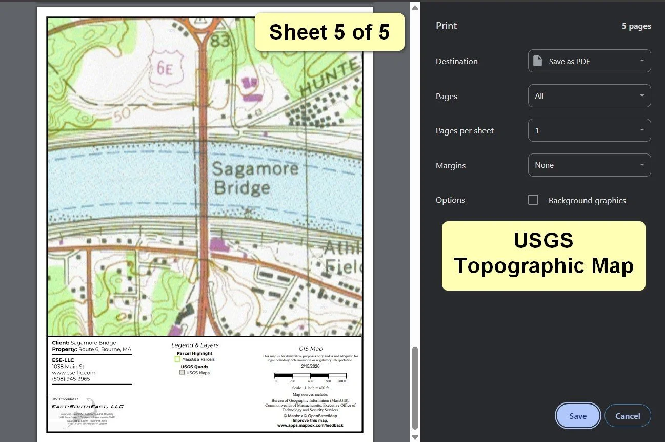
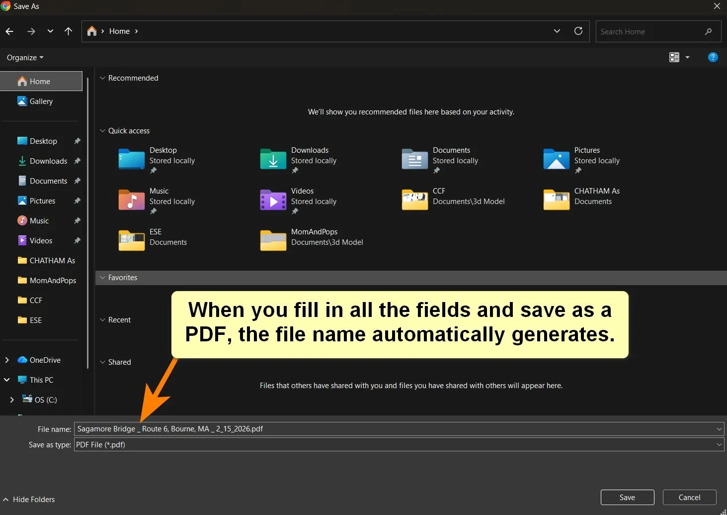
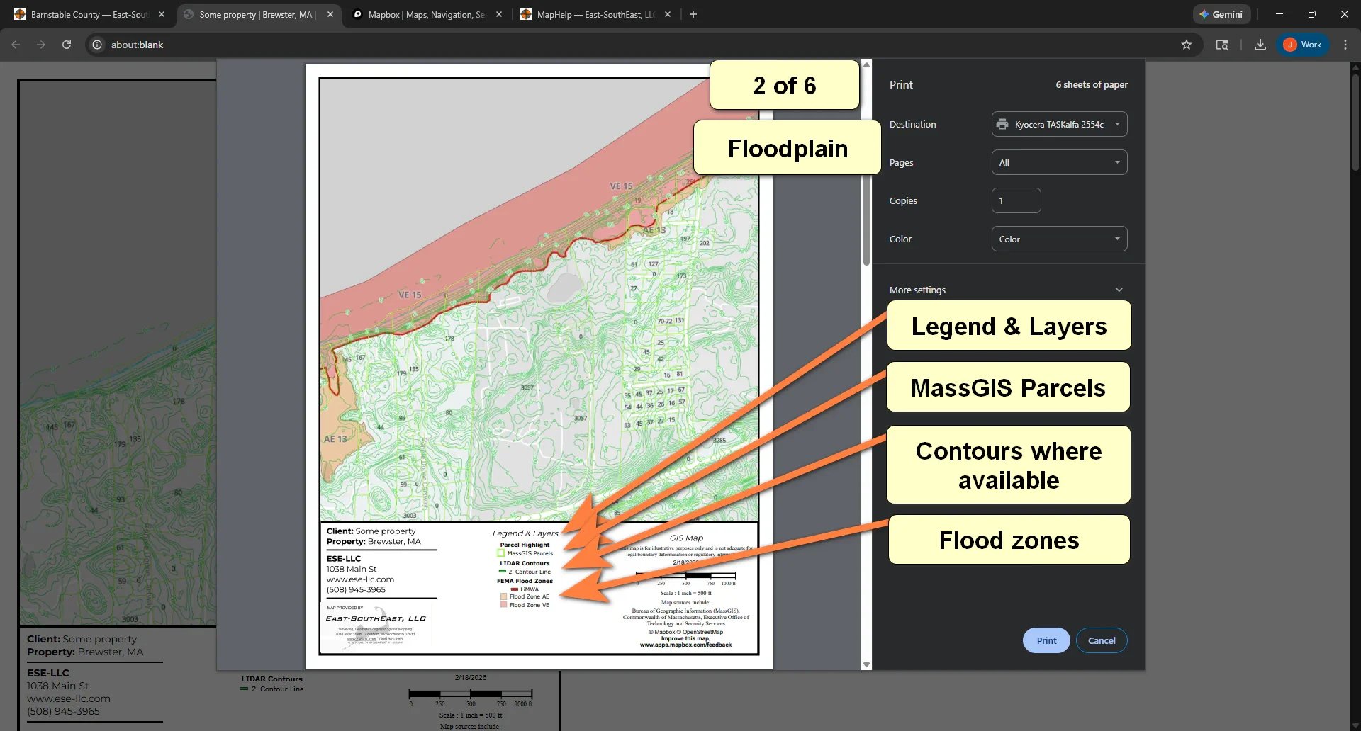
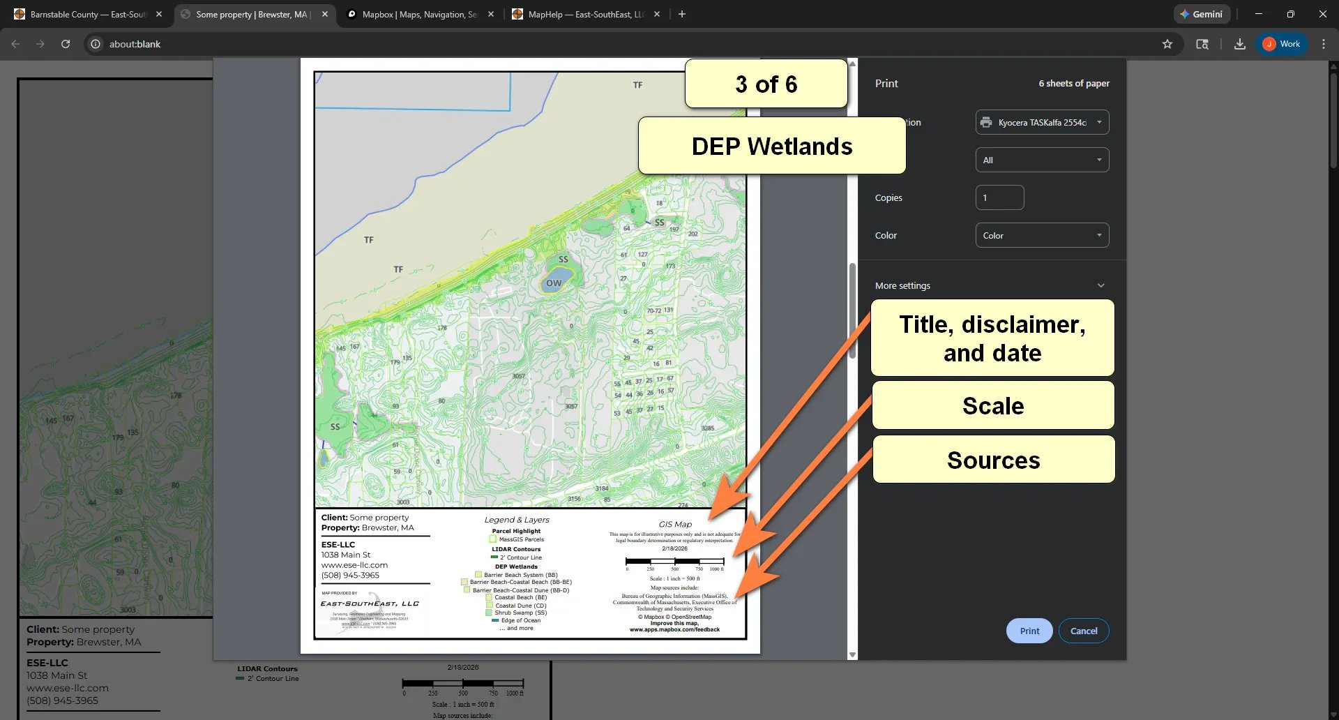
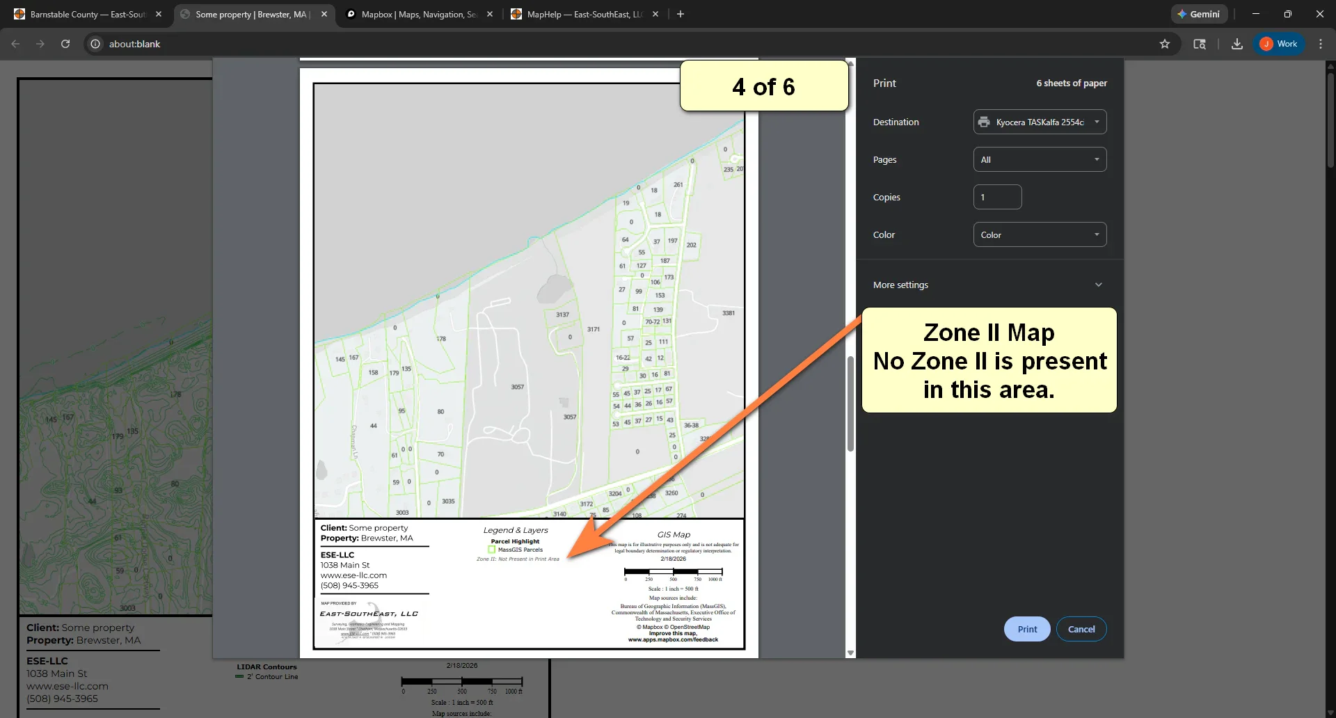
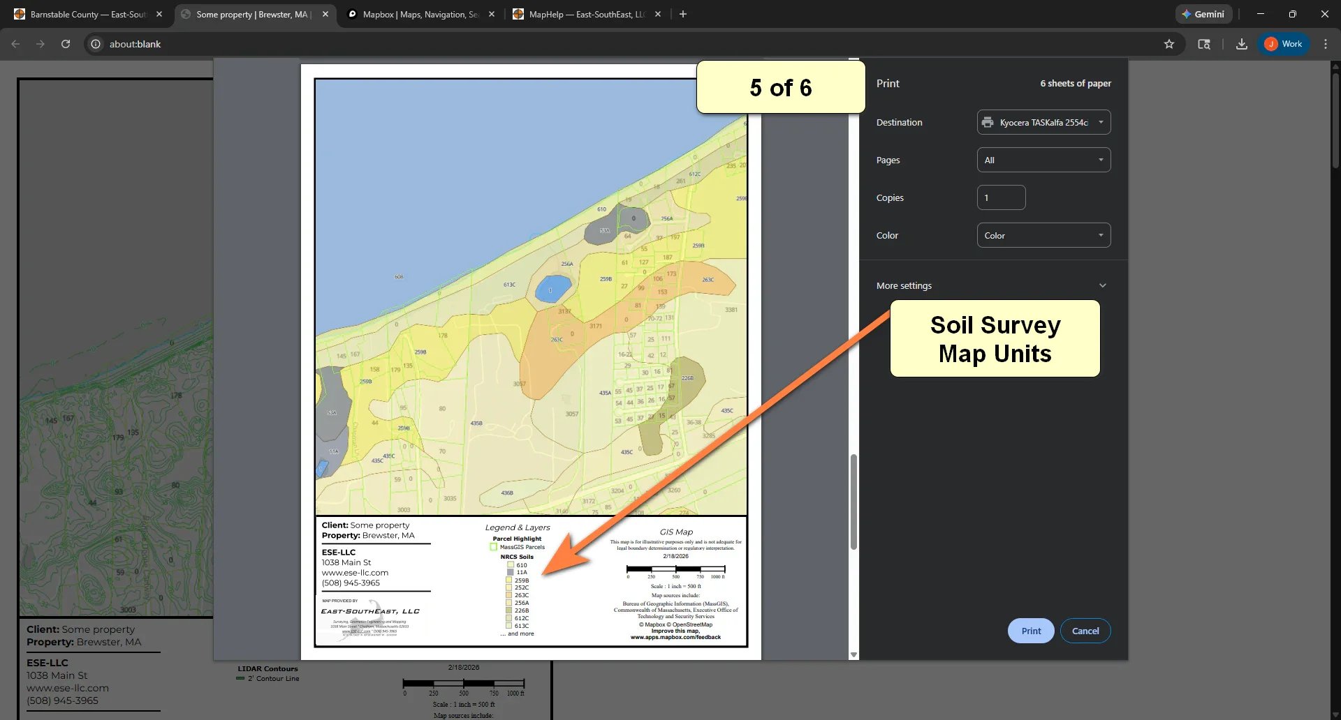
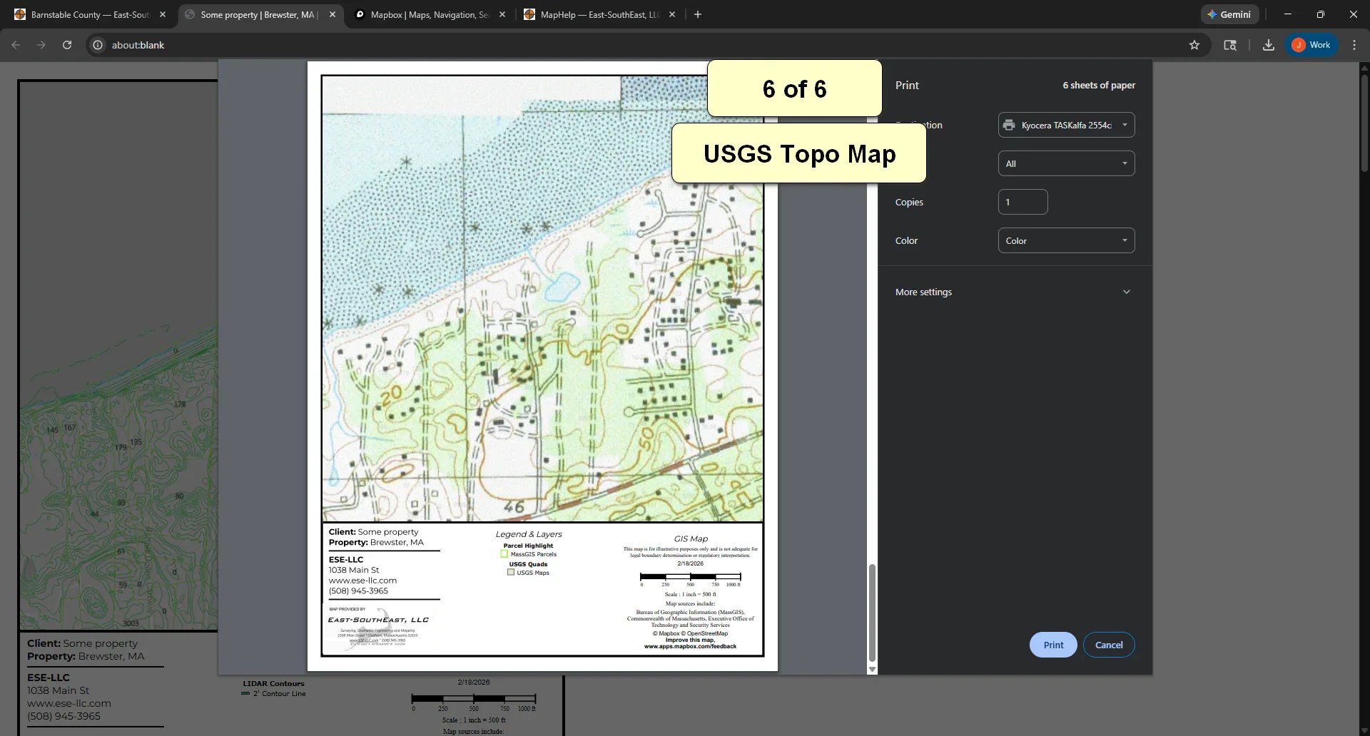
County Maps - Multi-page for Conservation
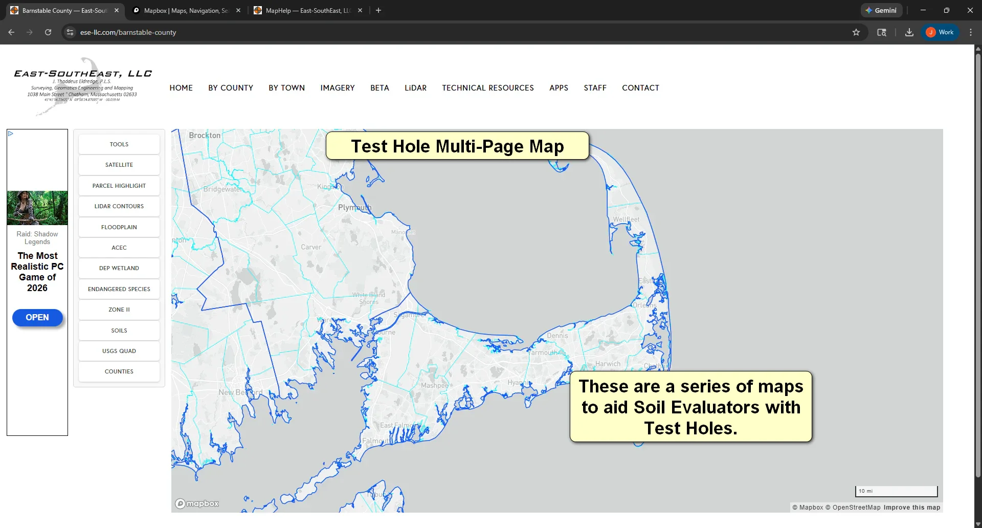
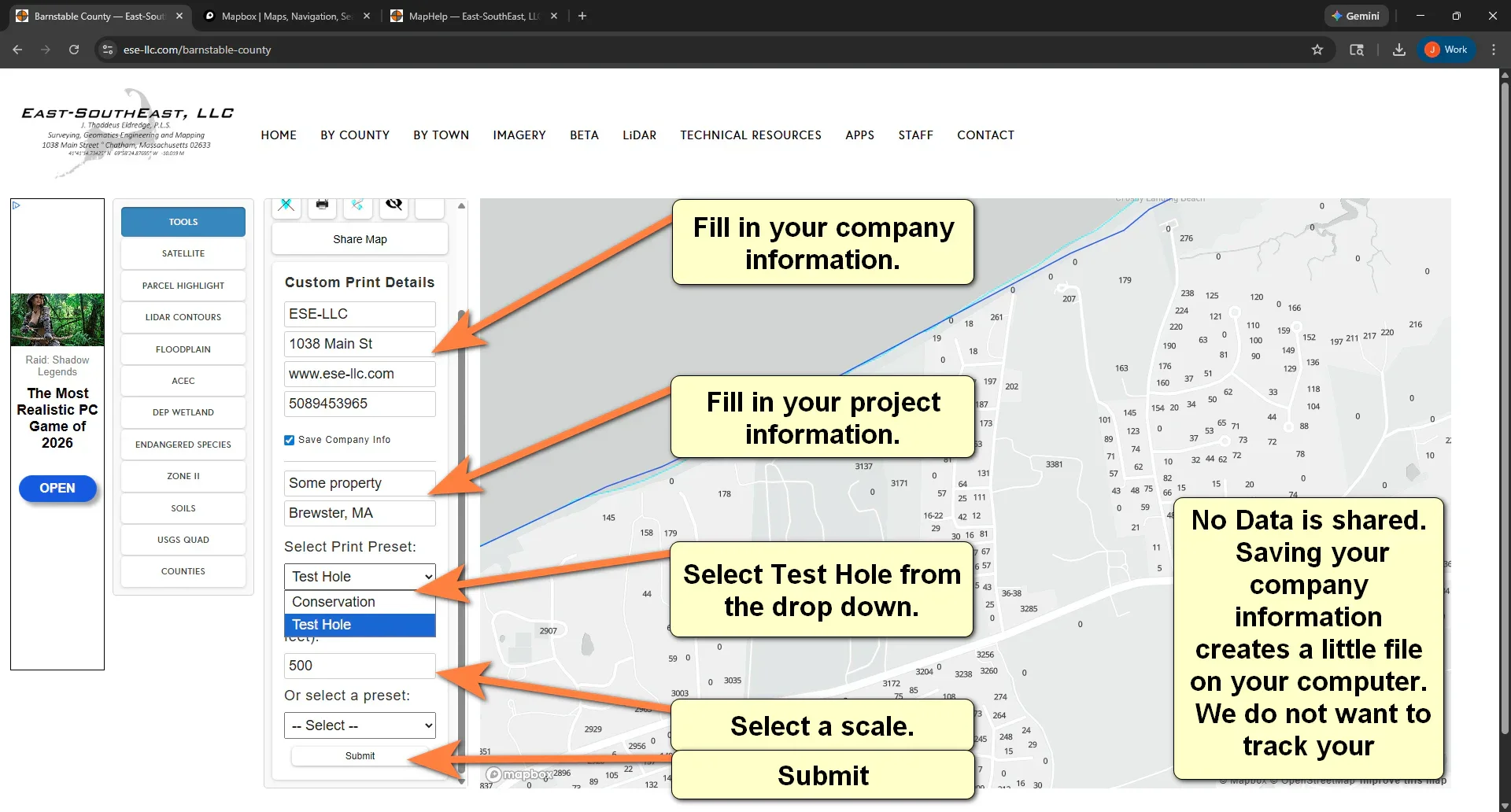
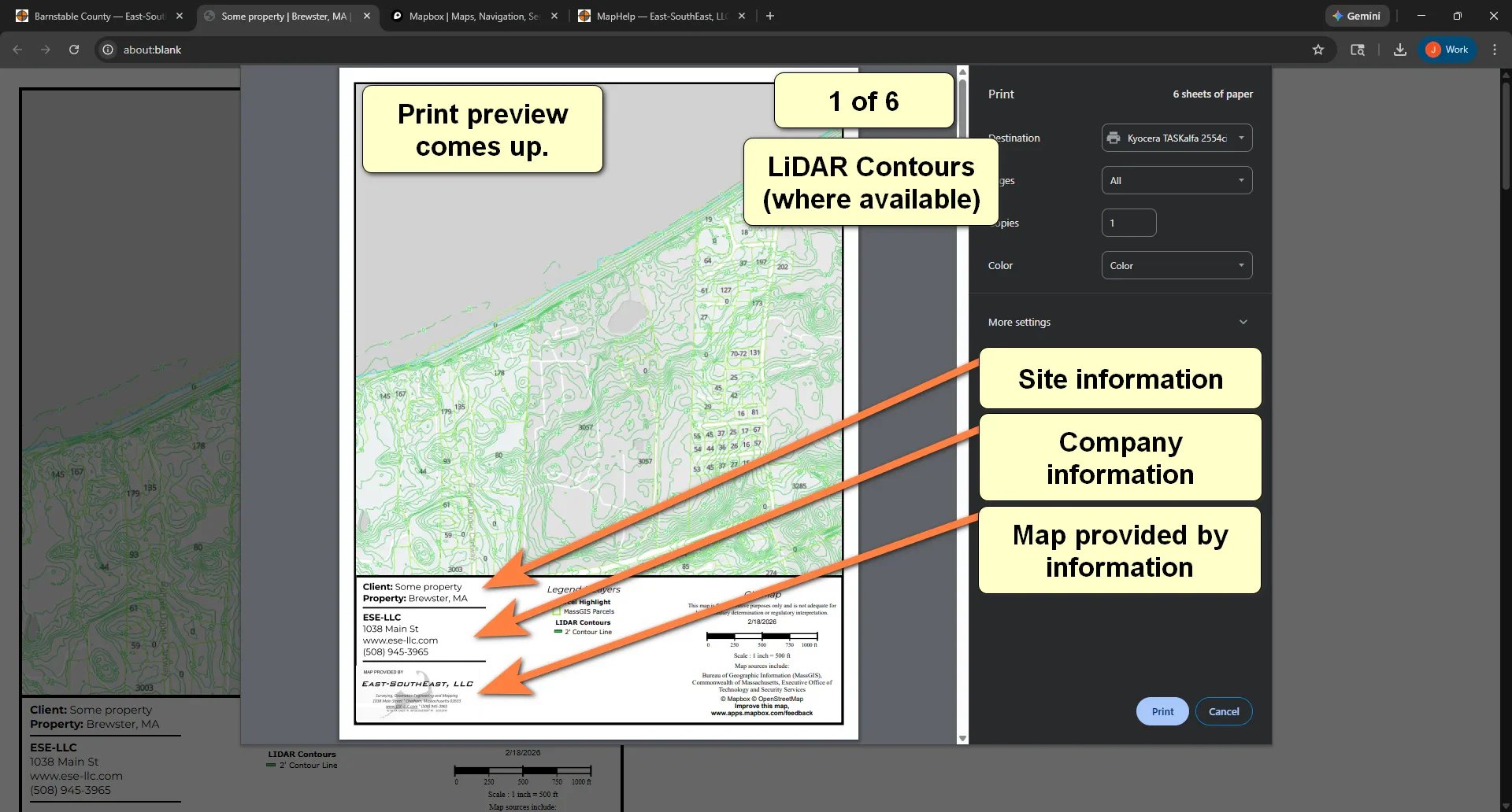
County Maps - Multi-page for Test Holes
To access the maps, look above at the BY COUNTY menu.
Data sources include MapBox, Bureau of Geographic Information (MassGIS), Commonwealth of Massachusetts, Executive Office of Technology and Security Services, and East-SouthEast, LLC. Be sure to use the information approrpiately.