ASSESSING INFORMATION- LAST UPDATED 10-11-2018
Parcel ID: 13B-37-C12
Assessors' Card
An aGIS map is available for this property. Click the image for the sales page or HERE for more information.

ASSESSING INFORMATION- LAST UPDATED 10-11-2018
Parcel ID: 13B-37-C12
Assessors' Card
An aGIS map is available for this property. Click the image for the sales page or HERE for more information.
ASSESSING INFORMATION- LAST UPDATED 10-11-2018
Parcel ID: 13B-2-C11
Assessors' Card
An aGIS map is available for this property. Click the image for the sales page or HERE for more information.
ASSESSING INFORMATION- LAST UPDATED 10-11-2018
Parcel ID: 14B-12-1
Assessors' Card
An aGIS map is available for this property. Click the image for the sales page or HERE for more information.
ASSESSING INFORMATION- LAST UPDATED 10-11-2018
Parcel ID: 13B-1-3
Assessors' Card
ASSESSING INFORMATION- LAST UPDATED 10-11-2018
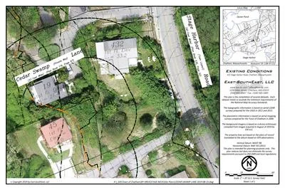
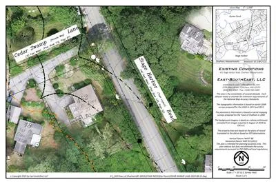
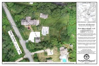
Parcel ID: 14A-10-8
Assessors' Card
Title Information
OOC Doc 1477299, D 35672-31
Deed into Tacoma Partners Limited Partnership DB 31407 PG 318 PB 180 PG 7 F2
Certificate into Tacoma Partners Limited Partnership Cert 216780 LC Plan 11626-E
Previous Certificate: Cert 173590
Previous Certificate: Cert 140512
Previous Certificate: Cert: 62593
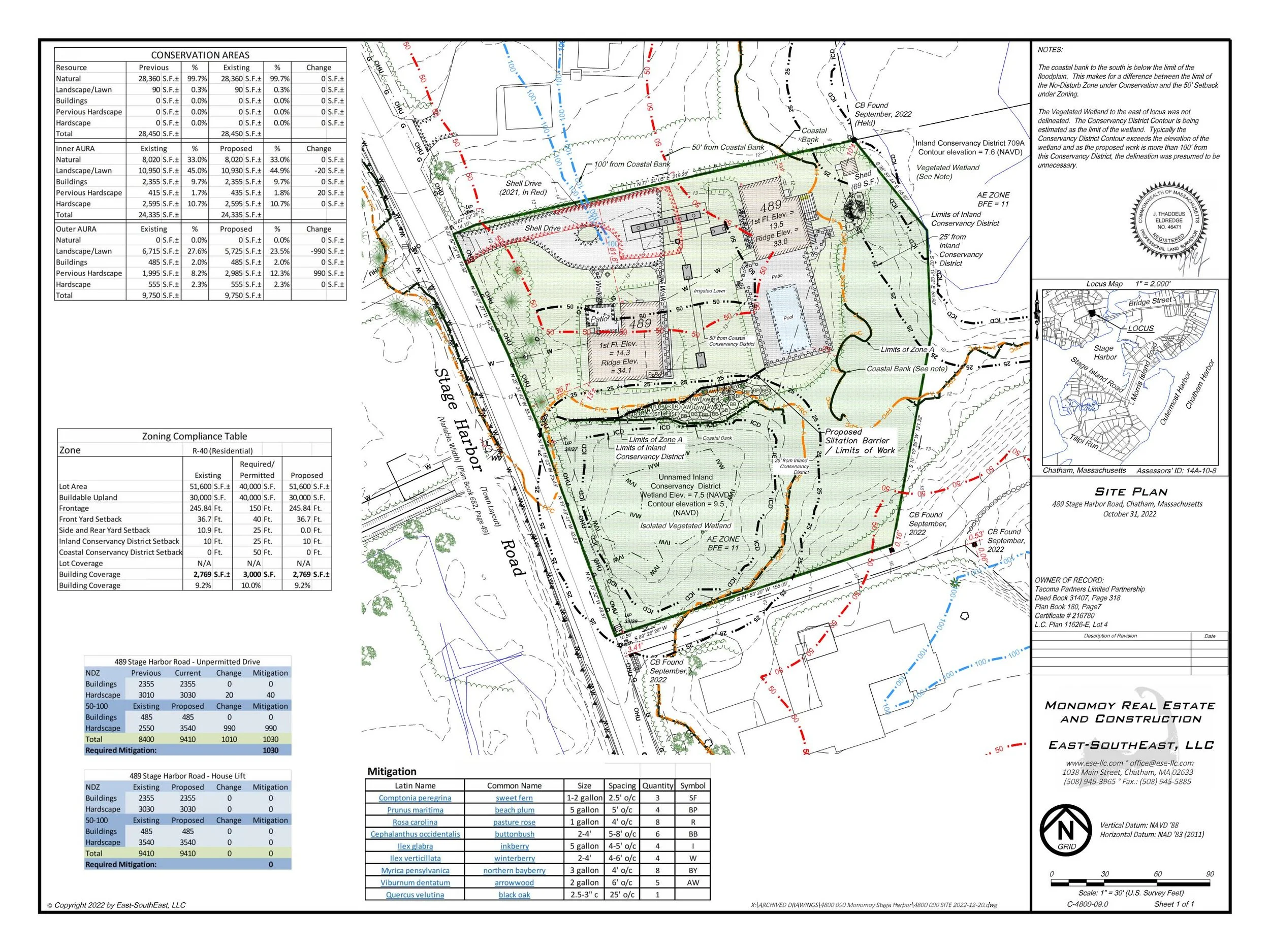
An aGIS map is available for this property. Click the image for the sales page or HERE for more information.
ASSESSING INFORMATION- LAST UPDATED 10-11-2018
Parcel ID: 14A-11-92
Assessors' Card

An aGIS map is available for this property. Click the image for the sales page or HERE for more information.
ASSESSING INFORMATION- LAST UPDATED 10-11-2018
Parcel ID: 14A-11B-91
Assessors' Card

An aGIS map is available for this property. Click the image for the sales page or HERE for more information.
ASSESSING INFORMATION- LAST UPDATED 10-11-2018
Parcel ID: 14A-6-4
Assessors' Card

An aGIS map is available for this property. Click the image for the sales page or HERE for more information.
ASSESSING INFORMATION- LAST UPDATED 10-11-2018
Parcel ID: 13A-37-F4
Assessors' Card
ASSESSING INFORMATION- LAST UPDATED 10-11-2018
Parcel ID: 14A-7-3
Assessors' Card

An aGIS map is available for this property. Click the image for the sales page or HERE for more information.
ASSESSING INFORMATION- LAST UPDATED 10-11-2018
Parcel ID: 14A-8-12
Assessors' Card

An aGIS map is available for this property. Click the image for the sales page or HERE for more information.
ASSESSING INFORMATION- LAST UPDATED 10-11-2018
Parcel ID: 13A-36-9
Assessors' Card
ASSESSING INFORMATION- LAST UPDATED 10-11-2018
Parcel ID: 13A-34-11
Assessors' Card
ASSESSING INFORMATION- LAST UPDATED 10-11-2018
Parcel ID: 13A-2-24
Assessors' Card
An aGIS map is available for this property. Click the image for the sales page or HERE for more information.
An aGIS map is available for this property. Click the image for the sales page or HERE for more information.
An aGIS map is available for this property. Click the image for the sales page or HERE for more information.