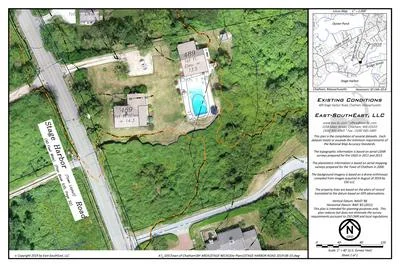
ASSESSING INFORMATION- LAST UPDATED 10-11-2018
Parcel ID: 14B-18-4
Assessors' Card
An aGIS map is available for this property. Click the image for the sales page or HERE for more information.


ASSESSING INFORMATION- LAST UPDATED 10-11-2018
Parcel ID: 14B-18-4
Assessors' Card
An aGIS map is available for this property. Click the image for the sales page or HERE for more information.

ASSESSING INFORMATION- LAST UPDATED 10-11-2018
Parcel ID: 13B-27-RC1
Assessors' Card

ASSESSING INFORMATION- LAST UPDATED 10-11-2018
Parcel ID: 13B-36A-23A
Assessors' Card
Research:
8814-174 1993 Deed
An aGIS map is available for this property. Click the image for the sales page or HERE for more information.
ASSESSING INFORMATION- LAST UPDATED 10-11-2018
Parcel ID: 13B-25-7
Assessors' Card
An aGIS map is available for this property. Click the image for the sales page or HERE for more information.
ASSESSING INFORMATION- LAST UPDATED 10-11-2018
Parcel ID: 13B-23-19
Assessors' Card
ASSESSING INFORMATION- LAST UPDATED 10-11-2018
Parcel ID: 13B-36-23
Assessors' Card
Research
22897-194 2008 Deed

An aGIS map is available for this property. Click the image for the sales page or HERE for more information.
ASSESSING INFORMATION- LAST UPDATED 10-11-2018
Parcel ID: 13B-24-6
Assessors' Card
An aGIS map is available for this property. Click the image for the sales page or HERE for more information.
ASSESSING INFORMATION- LAST UPDATED 10-11-2018
Parcel ID: 13B-5-C1
Assessors' Card

An aGIS map is available for this property. Click the image for the sales page or HERE for more information.
ASSESSING INFORMATION- LAST UPDATED 10-11-2018
Parcel ID: 13B-37-C12
Assessors' Card
An aGIS map is available for this property. Click the image for the sales page or HERE for more information.
ASSESSING INFORMATION- LAST UPDATED 10-11-2018
Parcel ID: 13B-2-C11
Assessors' Card
An aGIS map is available for this property. Click the image for the sales page or HERE for more information.
ASSESSING INFORMATION- LAST UPDATED 10-11-2018
Parcel ID: 14B-12-1
Assessors' Card
An aGIS map is available for this property. Click the image for the sales page or HERE for more information.
ASSESSING INFORMATION- LAST UPDATED 10-11-2018
Parcel ID: 13B-1-3
Assessors' Card
ASSESSING INFORMATION- LAST UPDATED 10-11-2018
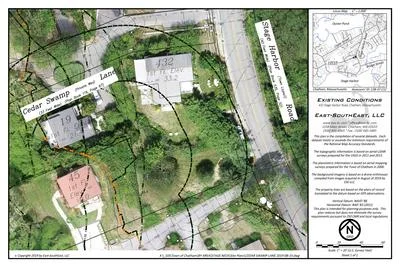
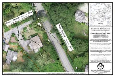
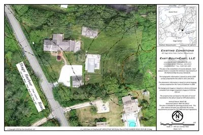
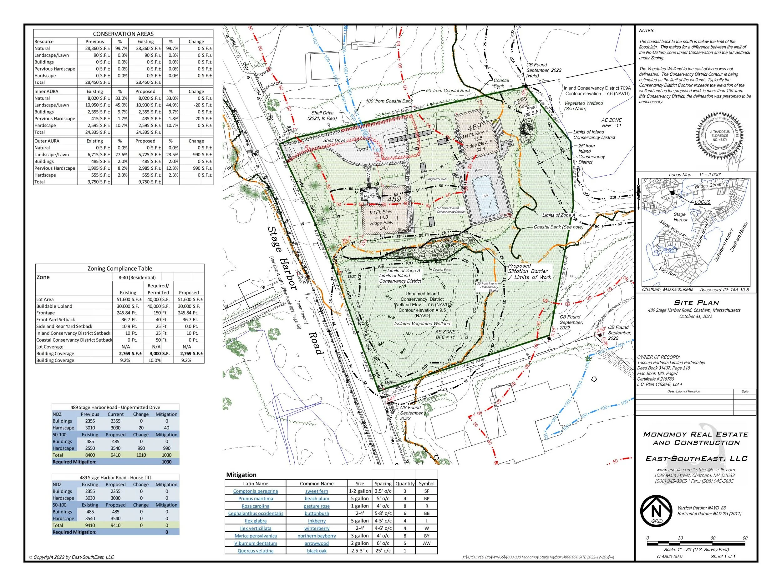
Parcel ID: 14A-10-8
Assessors' Card
Title Information
OOC Doc 1477299, D 35672-31
Deed into Tacoma Partners Limited Partnership DB 31407 PG 318 PB 180 PG 7 F2
Certificate into Tacoma Partners Limited Partnership Cert 216780 LC Plan 11626-E
Previous Certificate: Cert 173590
Previous Certificate: Cert 140512
Previous Certificate: Cert: 62593
An aGIS map is available for this property. Click the image for the sales page or HERE for more information.
ASSESSING INFORMATION- LAST UPDATED 10-11-2018
Parcel ID: 14A-11-92
Assessors' Card

An aGIS map is available for this property. Click the image for the sales page or HERE for more information.
ASSESSING INFORMATION- LAST UPDATED 10-11-2018
Parcel ID: 14A-11B-91
Assessors' Card

An aGIS map is available for this property. Click the image for the sales page or HERE for more information.
ASSESSING INFORMATION- LAST UPDATED 10-11-2018
Parcel ID: 14A-6-4
Assessors' Card

An aGIS map is available for this property. Click the image for the sales page or HERE for more information.
ASSESSING INFORMATION- LAST UPDATED 10-11-2018
Parcel ID: 13A-37-F4
Assessors' Card
ASSESSING INFORMATION- LAST UPDATED 10-11-2018
Parcel ID: 14A-7-3
Assessors' Card

An aGIS map is available for this property. Click the image for the sales page or HERE for more information.
ASSESSING INFORMATION- LAST UPDATED 10-11-2018
Parcel ID: 14A-8-12
Assessors' Card

An aGIS map is available for this property. Click the image for the sales page or HERE for more information.
ASSESSING INFORMATION- LAST UPDATED 10-11-2018
Parcel ID: 13A-36-9
Assessors' Card