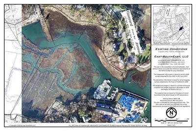
ASSESSING INFORMATION- LAST UPDATED 10-09-2018
Parcel ID: 14I-38E-N26
Assessors' Card
An aGIS map is available for this property. Click the image for the sales page or HERE for more information.

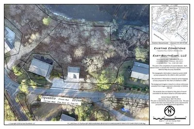
ASSESSING INFORMATION- LAST UPDATED 10-09-2018
Parcel ID: 14I-38E-N26
Assessors' Card
An aGIS map is available for this property. Click the image for the sales page or HERE for more information.
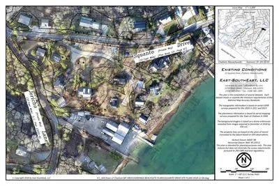
ASSESSING INFORMATION- LAST UPDATED 10-09-2018
Parcel ID: 14I-38D-N25
Assessors' Card
An aGIS map is available for this property. Click the image for the sales page or HERE for more information.
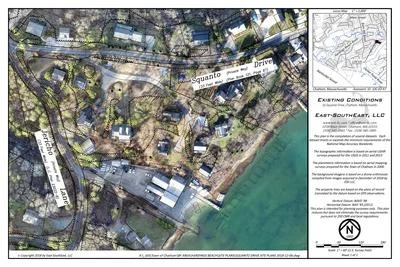
ASSESSING INFORMATION- LAST UPDATED 10-09-2018
Parcel ID: 14I-38C-N24
Assessors' Card
An aGIS map is available for this property. Click the image for the sales page or HERE for more information.
ASSESSING INFORMATION- LAST UPDATED 10-09-2018
Parcel ID: 14I-38B-N23
Assessors' Card
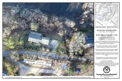
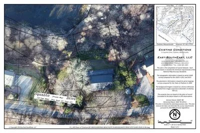
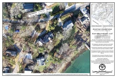
An aGIS map is available for this property. Click the image for the sales page or HERE for more information.
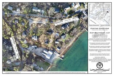
An aGIS map is available for this property. Click the image for the sales page or HERE for more information.
AKA -Tide Mill Lane
ASSESSING INFORMATION- LAST UPDATED 10-11-2018
Parcel ID: 10C-15-14A
Assessors' Card
An aGIS map is available for this property. Click the image for the sales page or HERE for more information.
ASSESSING INFORMATION- LAST UPDATED 10-11-2018
Parcel ID: 10C-60-X3
Assessors' Card
An aGIS map is available for this property. Click the image for the sales page or HERE for more information.
ASSESSING INFORMATION- LAST UPDATED 10-11-2018
Parcel ID: 10C-61-X1
Assessors' Card

An aGIS map is available for this property. Click the image for the sales page or HERE for more information.
ASSESSING INFORMATION- LAST UPDATED 10-11-2018
Parcel ID: 10C-62-X8
Assessors' Card

An aGIS map is available for this property. Click the image for the sales page or HERE for more information.
ASSESSING INFORMATION- LAST UPDATED 10-11-2018
Parcel ID: 10C-63-X7
Assessors' Card
An aGIS map is available for this property. Click the image for the sales page or HERE for more information.
ASSESSING INFORMATION- LAST UPDATED 10-11-2018
Parcel ID: 10C-64-X5
Assessors' Card
An aGIS map is available for this property. Click the image for the sales page or HERE for more information.
ASSESSING INFORMATION- LAST UPDATED 10-11-2018
Parcel ID: 10C-65-X9
Assessors' Card

An aGIS map is available for this property. Click the image for the sales page or HERE for more information.
ASSESSING INFORMATION- LAST UPDATED 10-11-2018
Parcel ID: 10C-66-X2
Assessors' Card

An aGIS map is available for this property. Click the image for the sales page or HERE for more information.
ASSESSING INFORMATION- LAST UPDATED 10-11-2018
Parcel ID: 10C-67-X6
Assessors' Card

An aGIS map is available for this property. Click the image for the sales page or HERE for more information.
ASSESSING INFORMATION- LAST UPDATED 10-11-2018
Parcel ID: 10C-16-E12
Assessors' Card
An aGIS map is available for this property. Click the image for the sales page or HERE for more information.
ASSESSING INFORMATION- LAST UPDATED 10-11-2018
Parcel ID: 10C-17-E11
Assessors' Card
An aGIS map is available for this property. Click the image for the sales page or HERE for more information.
ASSESSING INFORMATION- LAST UPDATED 10-11-2018
Parcel ID: 10C-24-E1
Assessors' Card
An aGIS map is available for this property. Click the image for the sales page or HERE for more information.
ASSESSING INFORMATION- LAST UPDATED 10-11-2018
Parcel ID: 10C-18-E16
Assessors' Card
An aGIS map is available for this property. Click the image for the sales page or HERE for more information.
ASSESSING INFORMATION- LAST UPDATED 10-11-2018
Parcel ID: 10C-23-E2
Assessors' Card
An aGIS map is available for this property. Click the image for the sales page or HERE for more information.