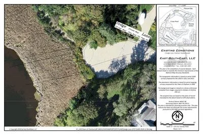
ASSESSING INFORMATION- LAST UPDATED 10-02-2018
Parcel ID: 15E-74-4A
Assessors' Card


An aGIS map is available for this property. Click the image for the sales page or HERE for more information.