
EASTWARD ROAD 2025 24
EASTWARD ROAD 2025 24
$95.00
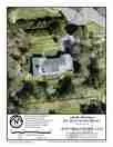
The aGIS map is an attempt to provide a quick overview of the property with recent drone imagery. The data may or may not be based on actual surveys and is NOT intended for legal, boundary, regulatory, or design.