
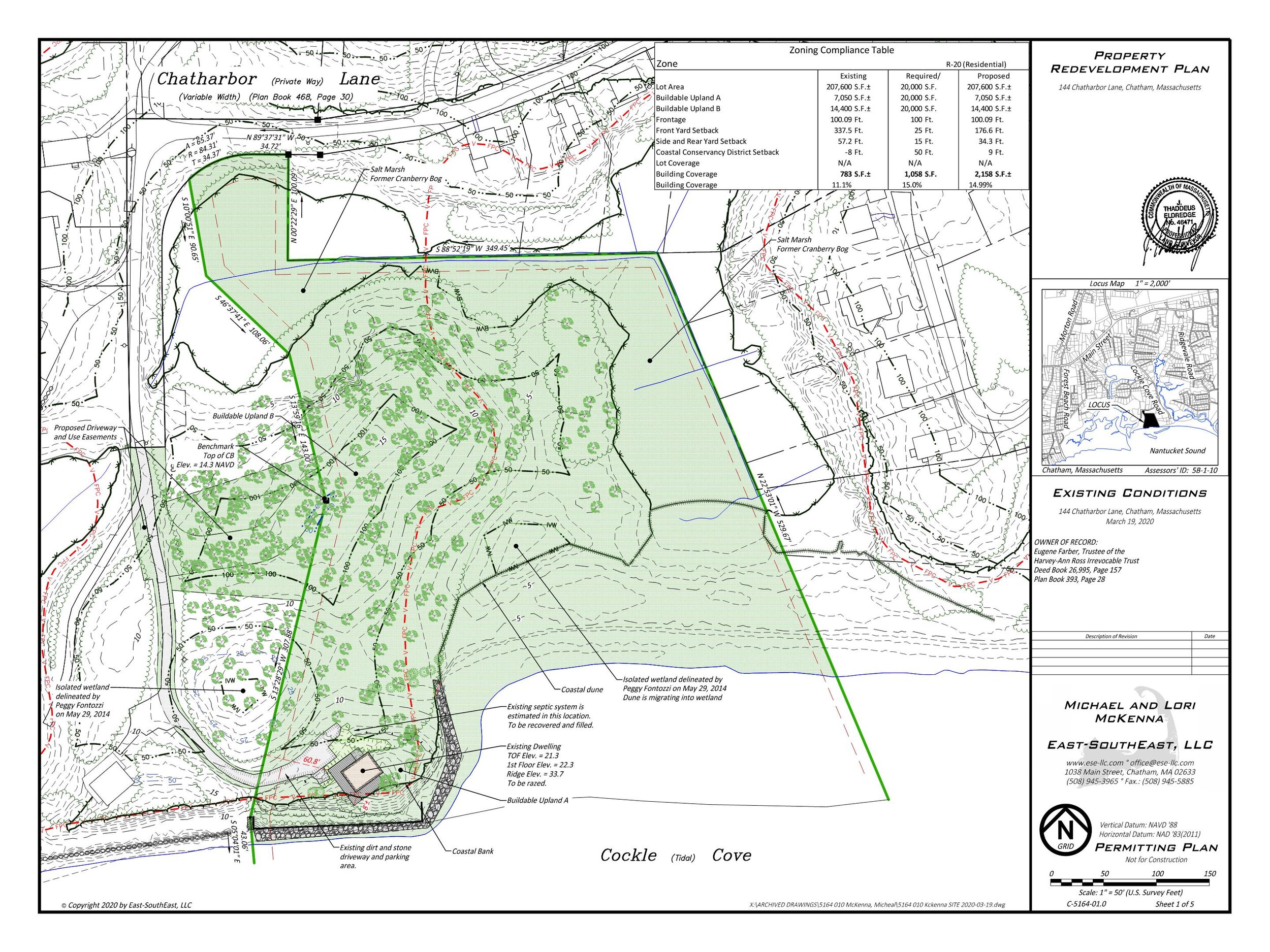
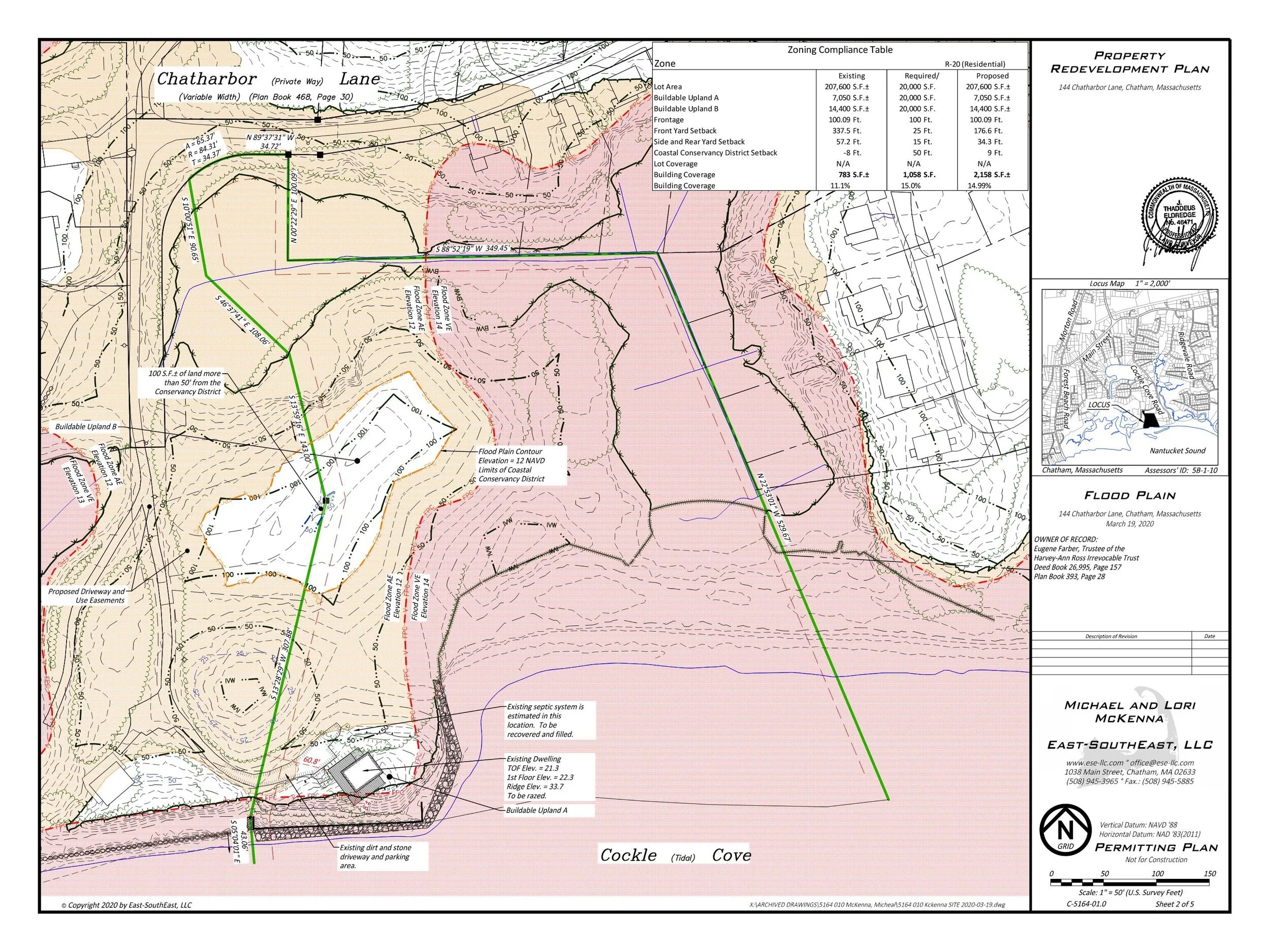
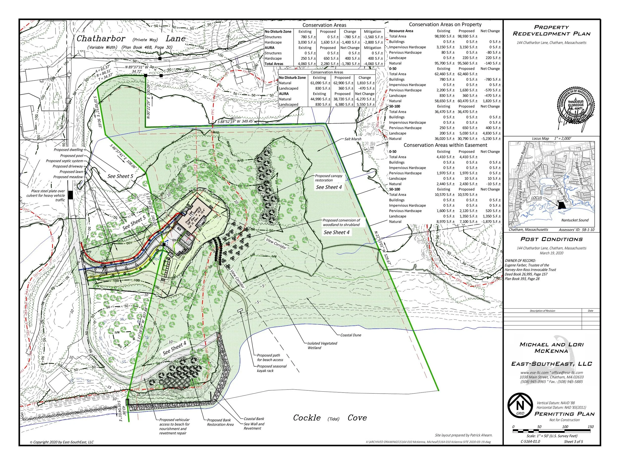
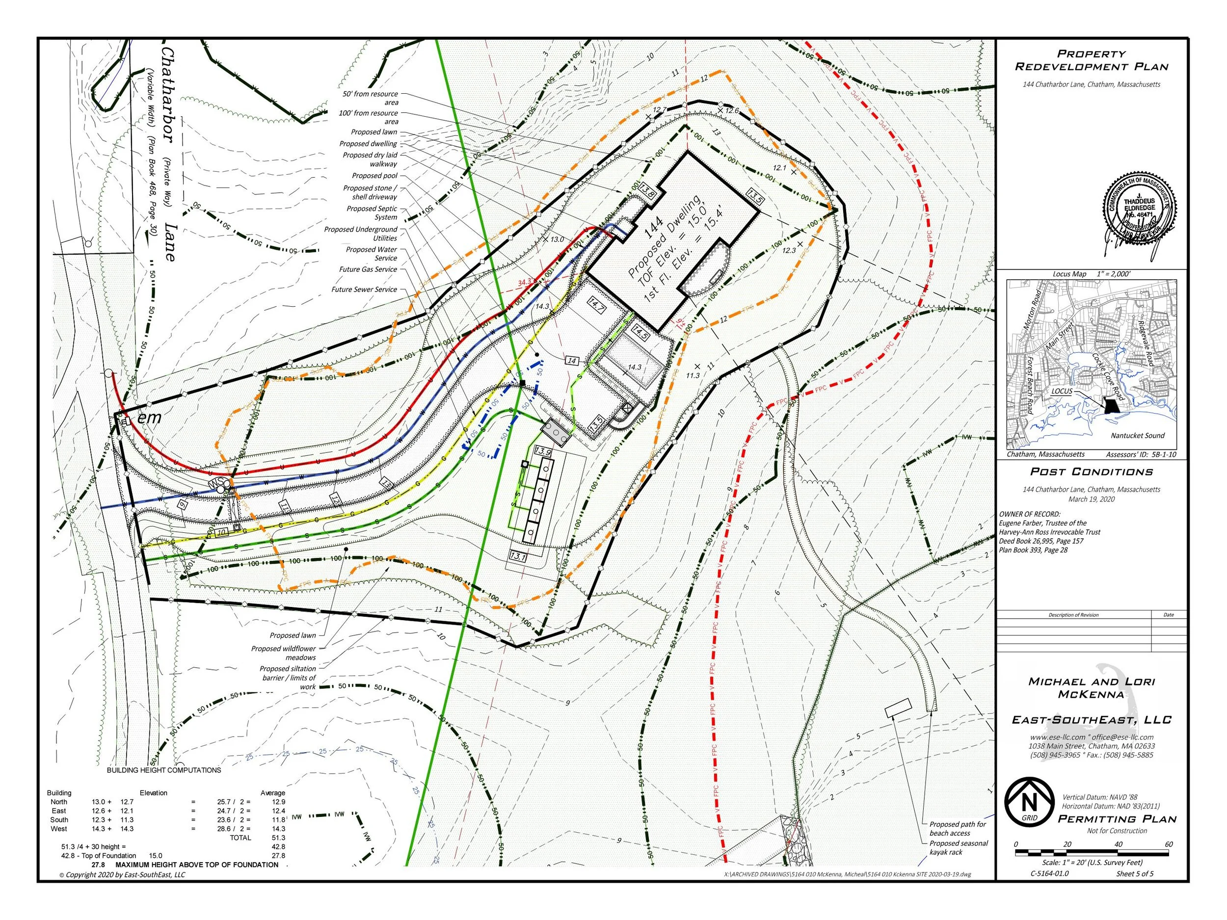
ASSESSING INFORMATION- LAST UPDATED 06-19-2018
Parcel ID: 5B-1-10
Assessors' Card

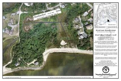
This video is based on drone imagery. The imagery acquired has been georeferenced and pixels from a minimum of 3 images are used to create 3d points with reasonable accuracy (0.5’ or better). Depending on the wind, trees will process. Two area have been flagged based on lack of data as the 3d did not process due to windy conditions. There is confidence in the locations that are available.
An aGIS map is available for this property. Click the image for the sales page or HERE for more information.