ASSESSING INFORMATION- LAST UPDATED 06-12-2018
Parcel ID: 3C-80-EAS4
Assessors' Card
aGIS or accurate GIS is an existing conditions plan exceeding the National Map Accuracy Standards with portions meeting the Survey Standards of 250 CMR.

ASSESSING INFORMATION- LAST UPDATED 06-12-2018
Parcel ID: 3C-80-EAS4
Assessors' Card
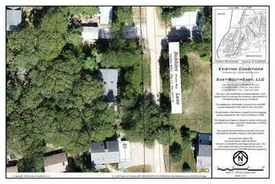
aGIS or accurate GIS is an existing conditions plan exceeding the National Map Accuracy Standards with portions meeting the Survey Standards of 250 CMR.