• HOME
    • Chatham
    • HarwichMA
    • Harwich
    • Dennis
    • Brewster
    • Orleans
    • Eastham
    • Wellfleet
    • WellfleetMA
    • Truro
    • Provincetown
    • --------------
    • Yarmouth
    • Barnstable
    • Mashpee
    • Falmouth
    • Sandwich
    • Bourne
    • Gosnold
    • Aquinnah
    • Chilmark
    • Tisbury
    • Edgartown
    • Nantucket
    • Barnstable County
    • North Reading
    • --------------
    • Website Instructions
    • Homepage Instructions
    • drone images
    • Drone Information
    • Drone Services
    • ===Drone Flights===
    • Drone Presentation 3rd Graders
    • Chatham Elementary Shark School
    • MassGIS Aerial Links
    • Mattacheese
    • MRHS Flag Pole
    • Site Photos
    • Pano Tours Testing
    • Zoning Temp
    • EDIT FRONT PAGE
    • Text Output
    • New Page
    • HOMEPAGE 2021
    • Probabilities
    • Handheld LiDAR
    • MADEP DEM Maps
    • SEWER TEST
    • surveyors
    • Panoramadama
    • Orienteering
    • ScannerJammer
    • Architectural Example
    • Sample Files
    • 2022 Septic Revisions
    • Cape Cod Tide Charts
    • Native Plants
    • Presentations
    • Datums Partially Explained
    • Regulations and Law
    • NHESP REPORTING
    • Scientific
    • Contractors
    • Surveyor Stats
    • Seminar Handouts
    • Map Instructions
    • Sewer
    • Merge NEZ
    • RW5 Renamer
    • NavVis Control Converter
    • -----Stable above, Beta below
    • RW5 Crawler
    • Panorama
    • APPS
    • ImageMapper
    • mlx-upload
    • Staff
    • J. Thaddeus Eldredge
    • Terry W. Eldredge
    • Cyndi Penny
    • Dan Croteau
    • Emma S. Eldredge
    • Luka S. Eldredge
    • Marija S. Eldredge
  • CONTACT
Menu

East-SouthEast, LLC

  • HOME
  • BY TOWN
    • Chatham
    • HarwichMA
    • Harwich
    • Dennis
    • Brewster
    • Orleans
    • Eastham
    • Wellfleet
    • WellfleetMA
    • Truro
    • Provincetown
    • --------------
    • Yarmouth
    • Barnstable
    • Mashpee
    • Falmouth
    • Sandwich
    • Bourne
    • Gosnold
    • Aquinnah
    • Chilmark
    • Tisbury
    • Edgartown
    • Nantucket
    • Barnstable County
    • North Reading
    • --------------
    • Website Instructions
    • Homepage Instructions
  • IMAGERY
    • drone images
    • Drone Information
    • Drone Services
    • ===Drone Flights===
    • Drone Presentation 3rd Graders
    • Chatham Elementary Shark School
    • MassGIS Aerial Links
    • Mattacheese
    • MRHS Flag Pole
  • BETA
    • Site Photos
    • Pano Tours Testing
    • Zoning Temp
    • EDIT FRONT PAGE
    • Text Output
    • New Page
    • HOMEPAGE 2021
    • Probabilities
    • Handheld LiDAR
    • MADEP DEM Maps
    • SEWER TEST
    • surveyors
    • Panoramadama
    • Orienteering
  • LiDAR
    • ScannerJammer
    • Architectural Example
    • Sample Files
  • TECHNICAL RESOURCES
    • 2022 Septic Revisions
    • Cape Cod Tide Charts
    • Native Plants
    • Presentations
    • Datums Partially Explained
    • Regulations and Law
    • NHESP REPORTING
    • Scientific
    • Contractors
    • Surveyor Stats
    • Seminar Handouts
    • Map Instructions
    • Sewer
  • APPS
    • Merge NEZ
    • RW5 Renamer
    • NavVis Control Converter
    • -----Stable above, Beta below
    • RW5 Crawler
    • Panorama
    • APPS
    • ImageMapper
    • mlx-upload
  • STAFF
    • Staff
    • J. Thaddeus Eldredge
    • Terry W. Eldredge
    • Cyndi Penny
    • Dan Croteau
    • Emma S. Eldredge
    • Luka S. Eldredge
    • Marija S. Eldredge
  • CONTACT
×
The pertinent plan of the 1975 Taking.  This depicts the drainage easements taken by the Town in 1975.  Full document can be downloaded here.  The quality is terrible but this is what was available at the Registry of Deeds.

The pertinent plan of the 1975 Taking. This depicts the drainage easements taken by the Town in 1975. Full document can be downloaded here. The quality is terrible but this is what was available at the Registry of Deeds.

Riverbay

ESE September 15, 2021

09-16-2021 Joshua Jethro Road, Chatham

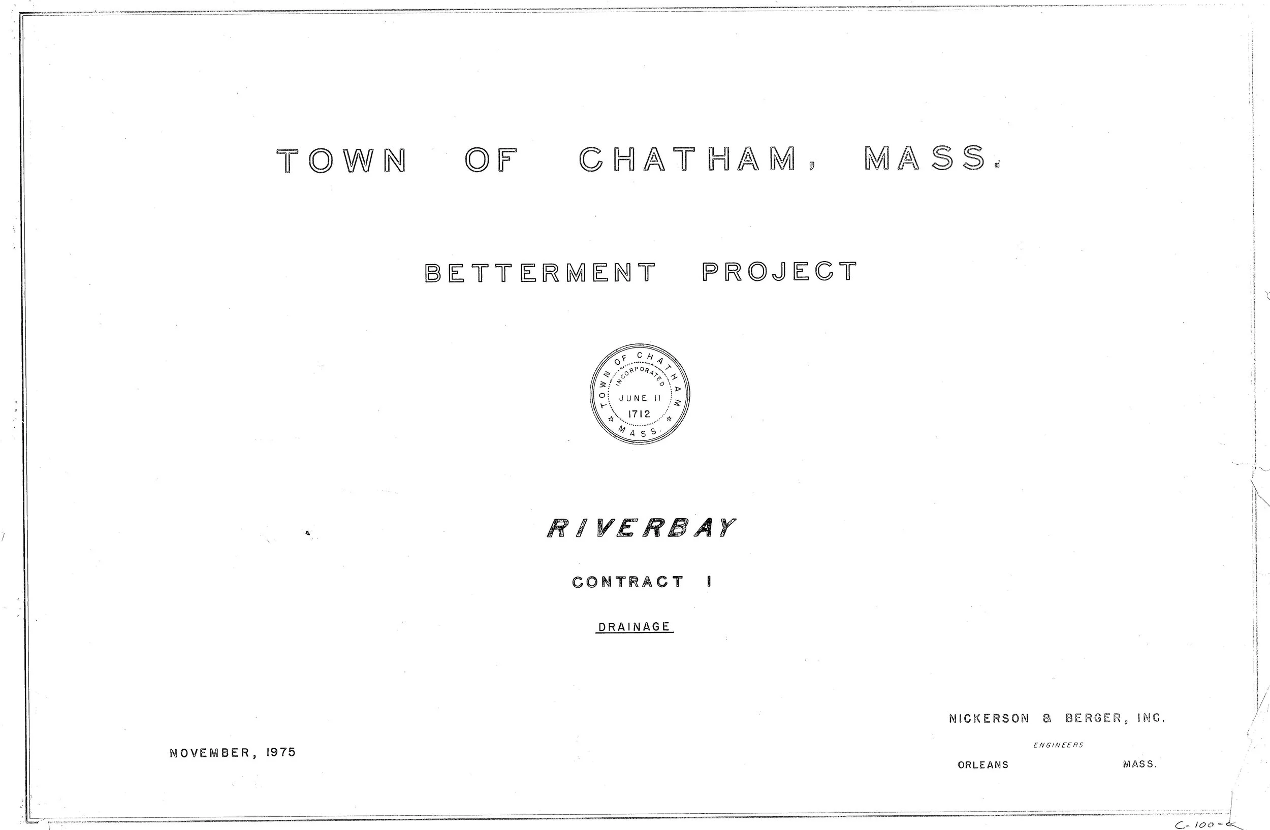
Riverbay Betterment Project, 1975
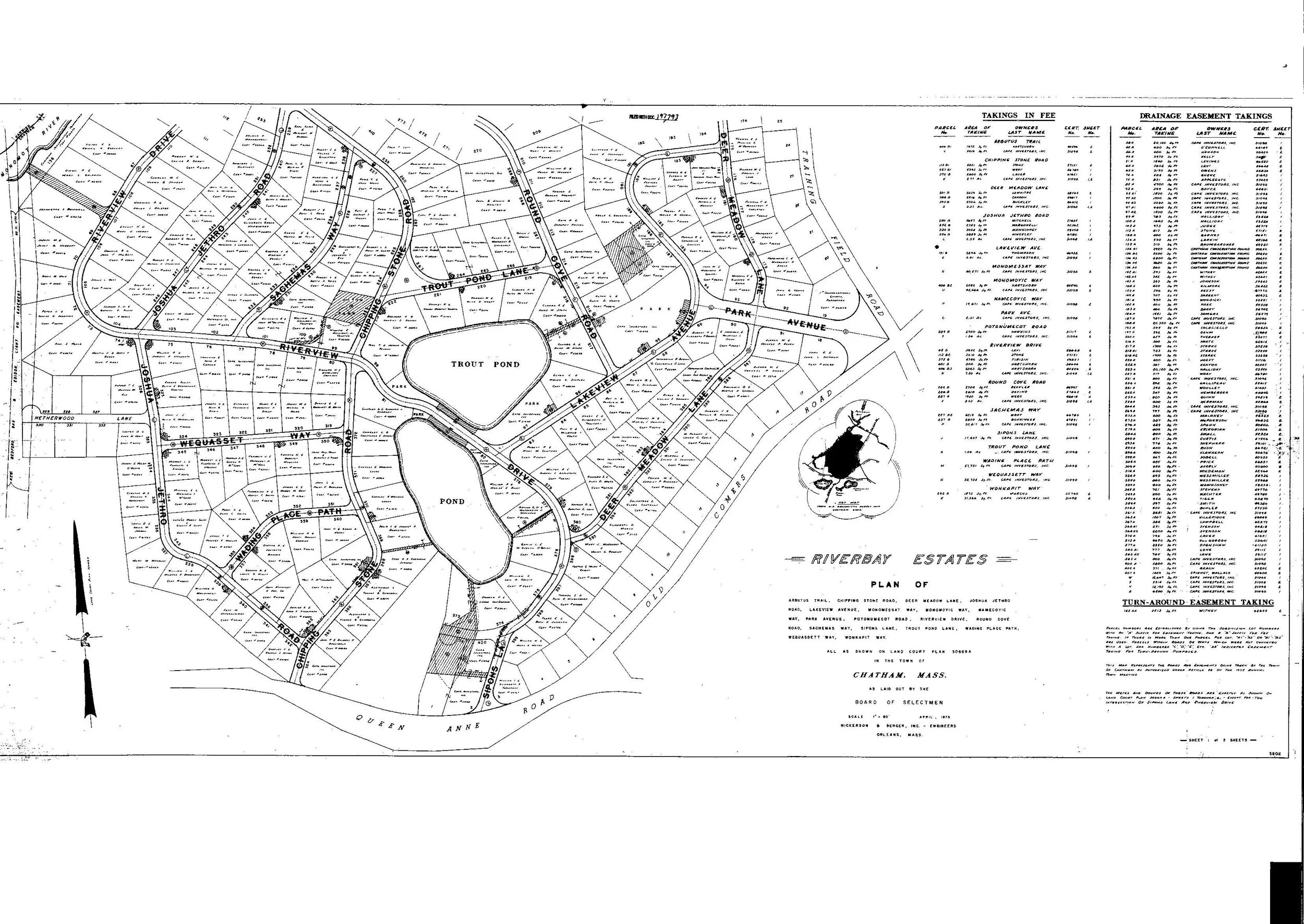
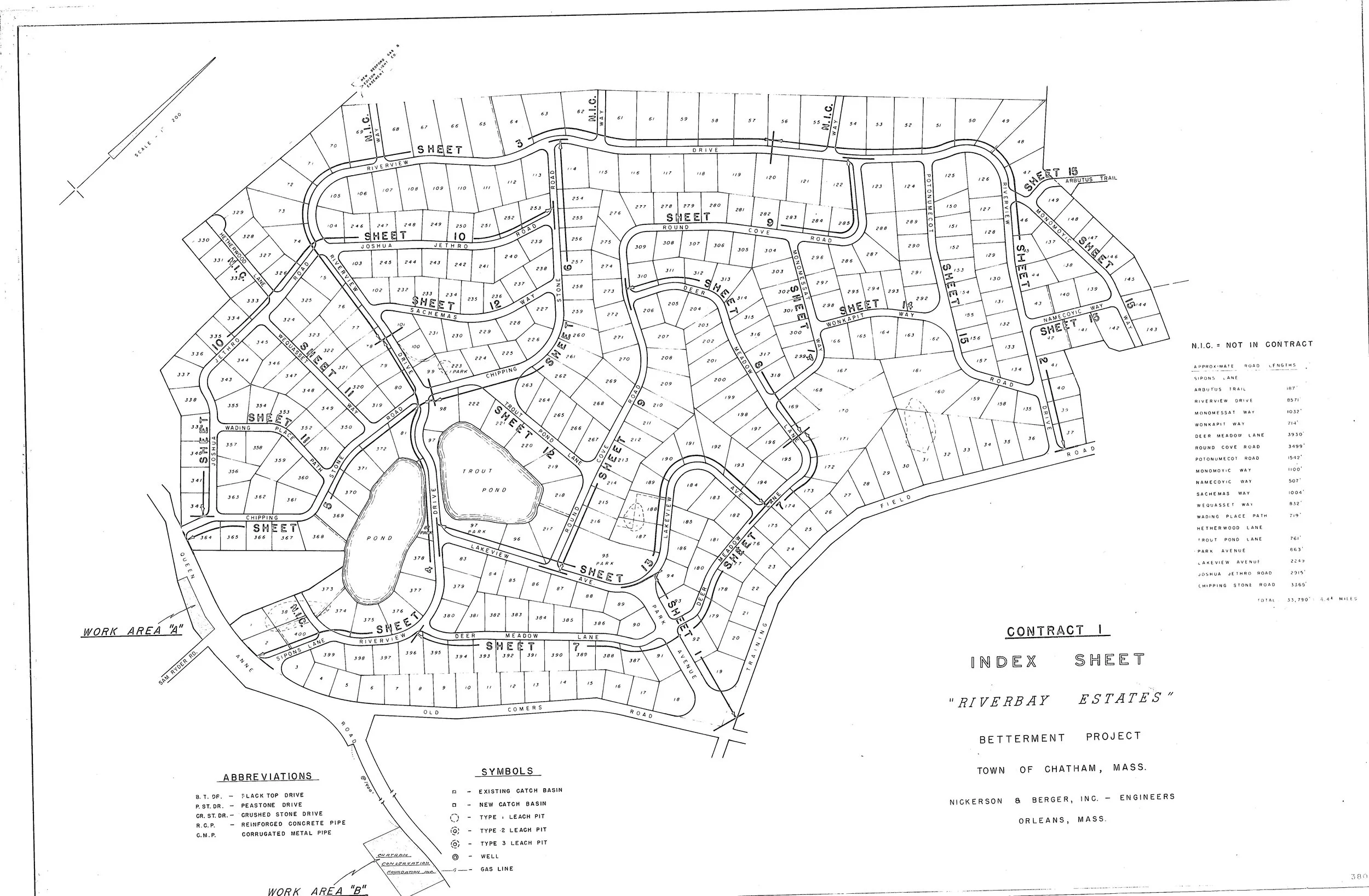
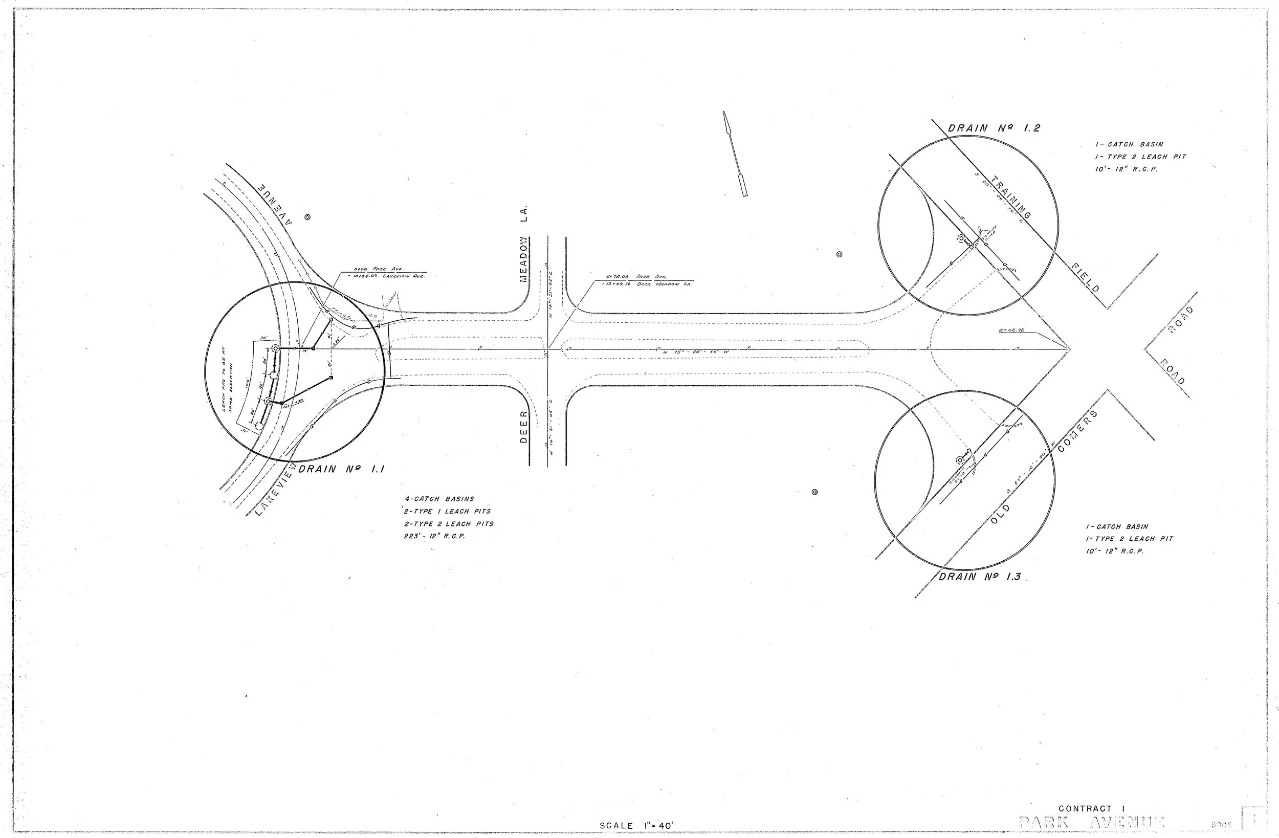
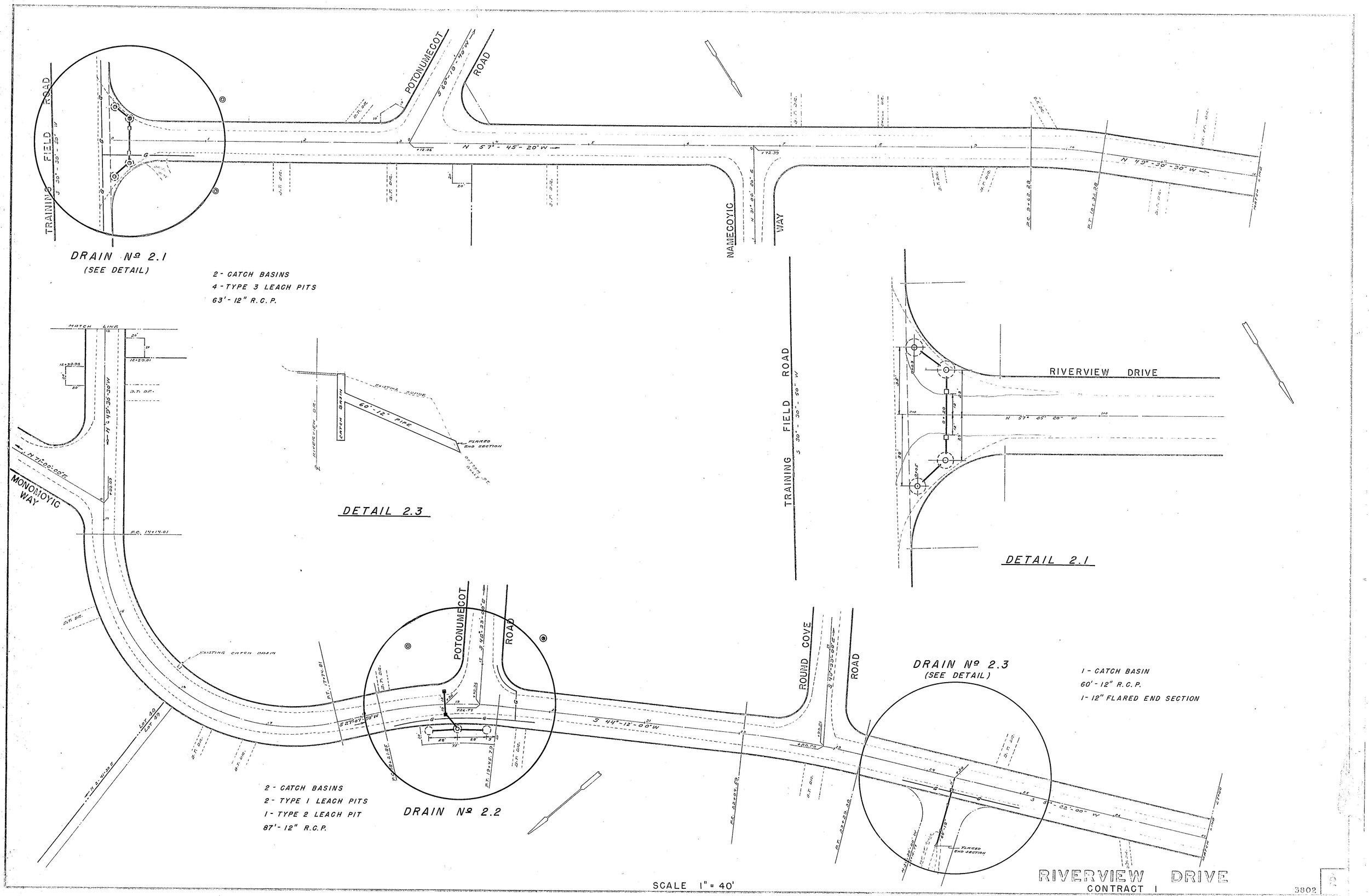
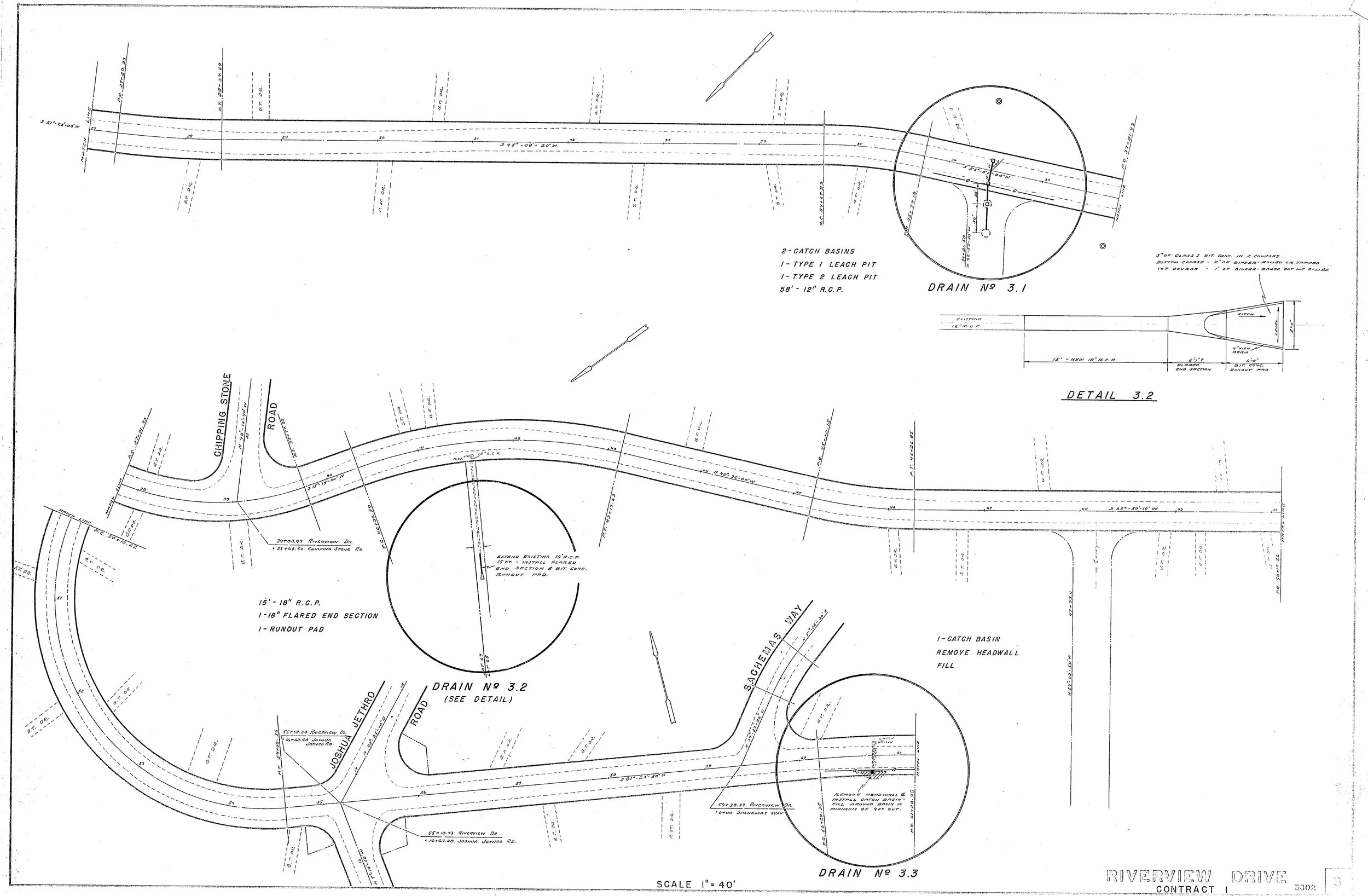
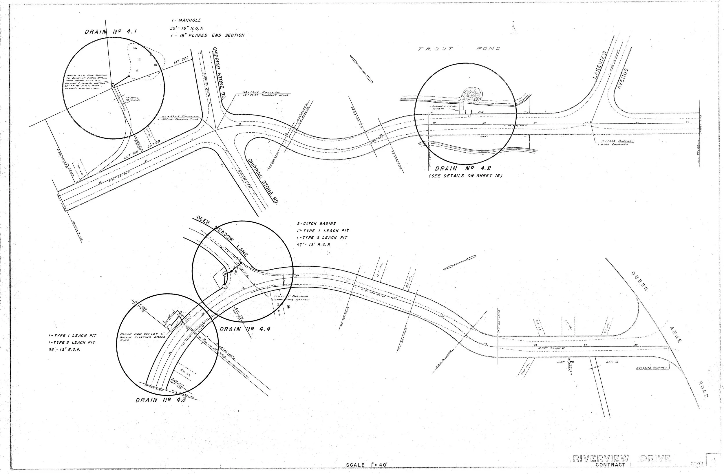
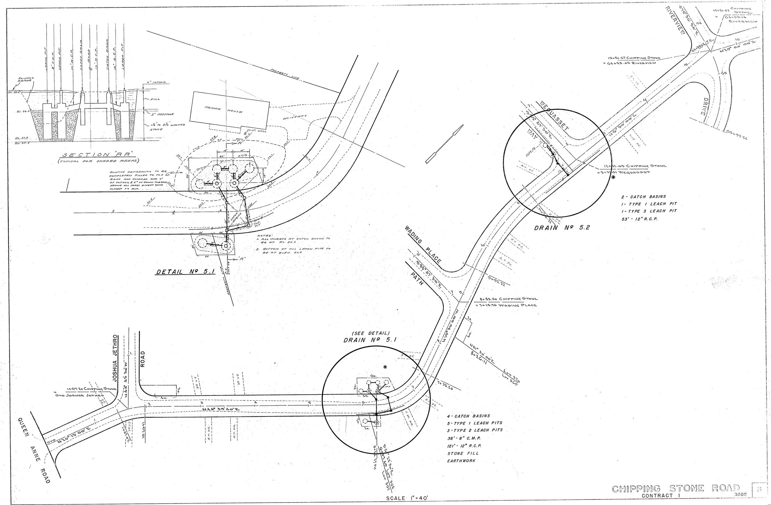
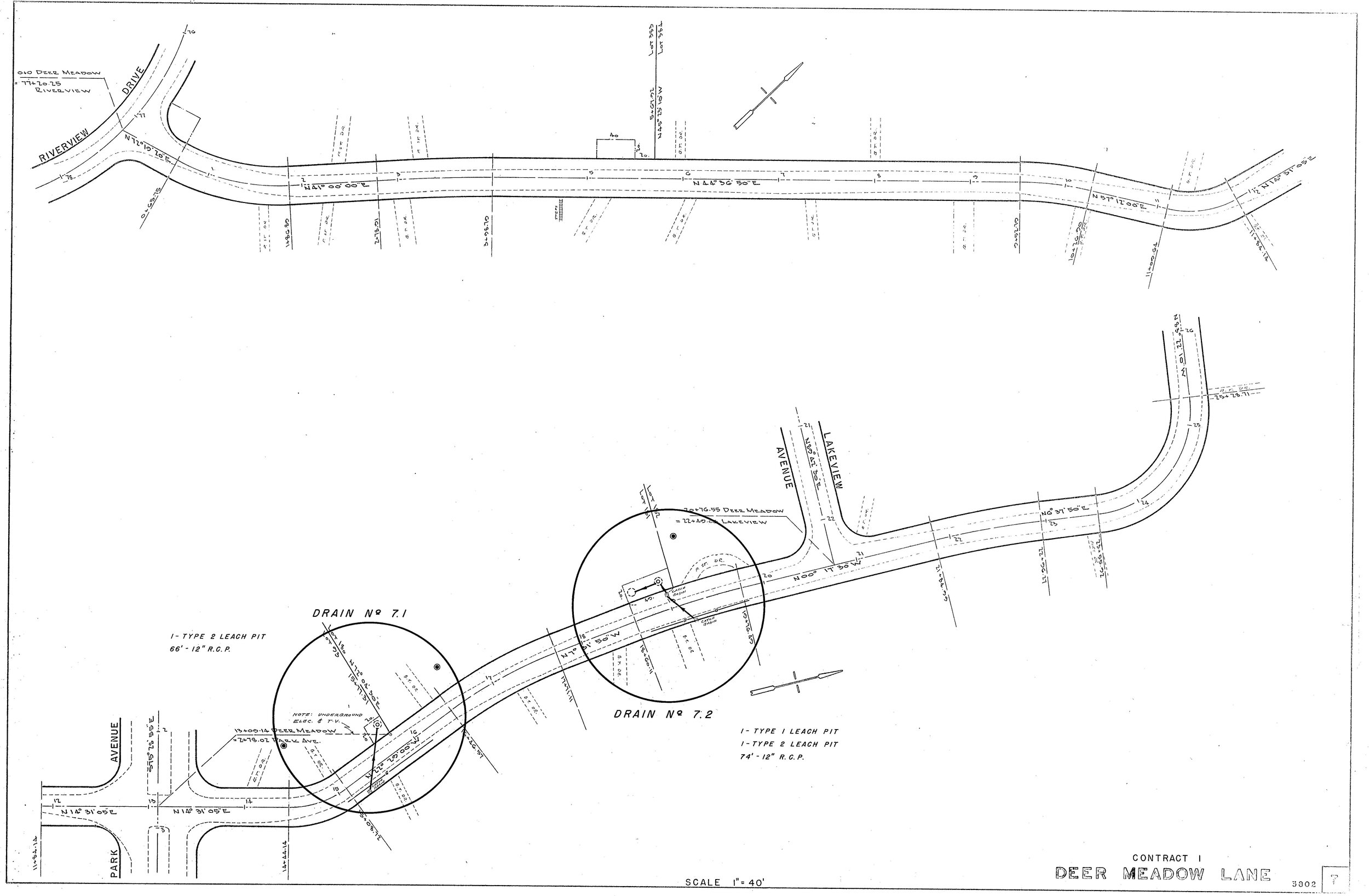
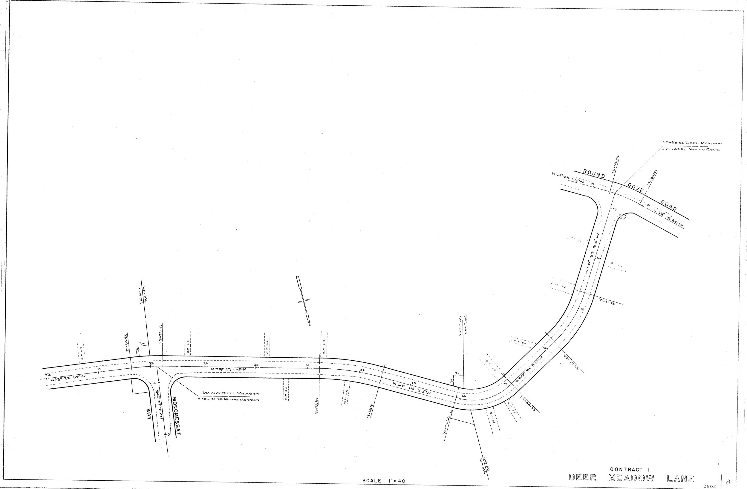
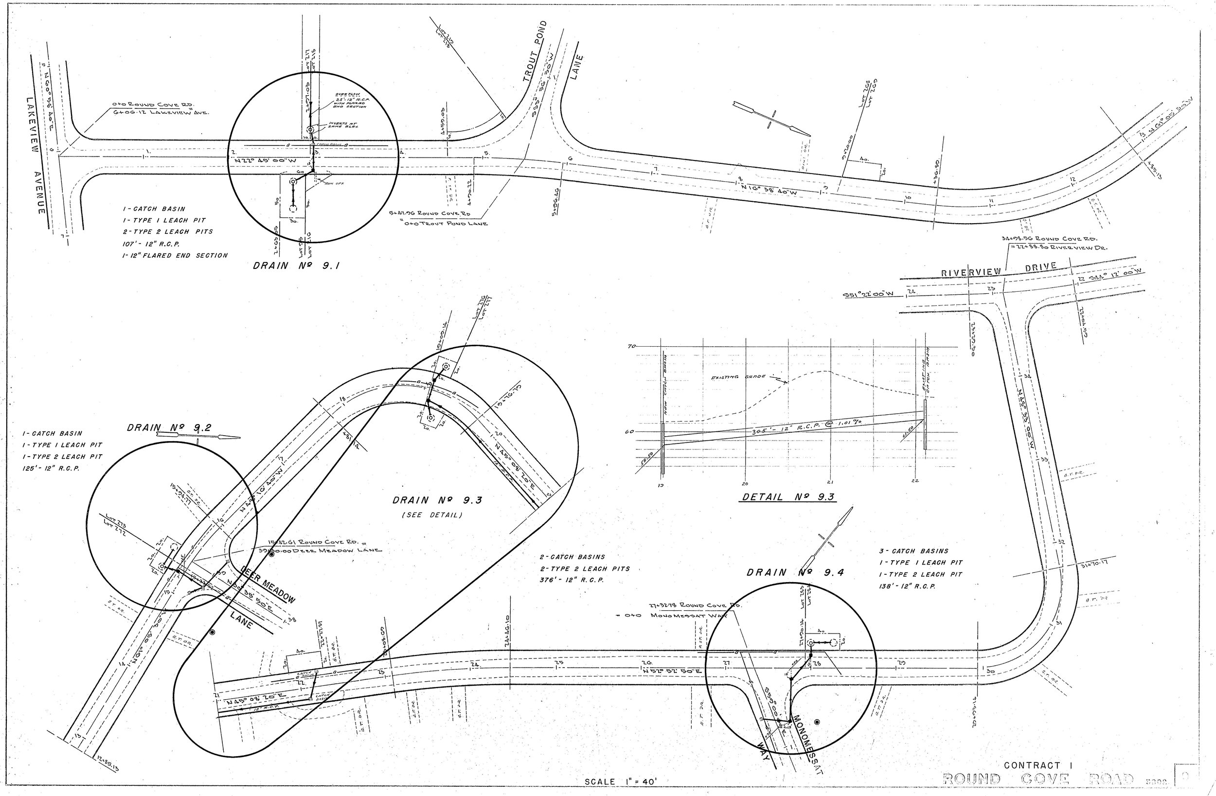
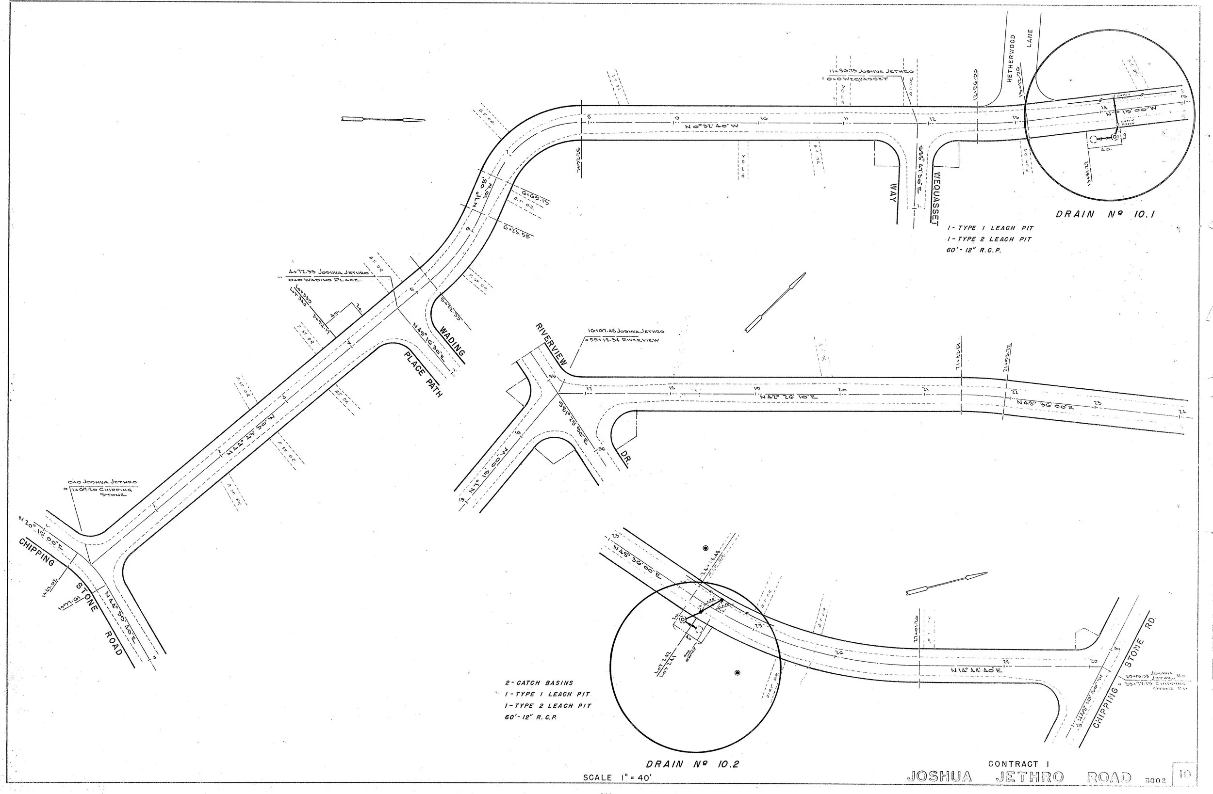
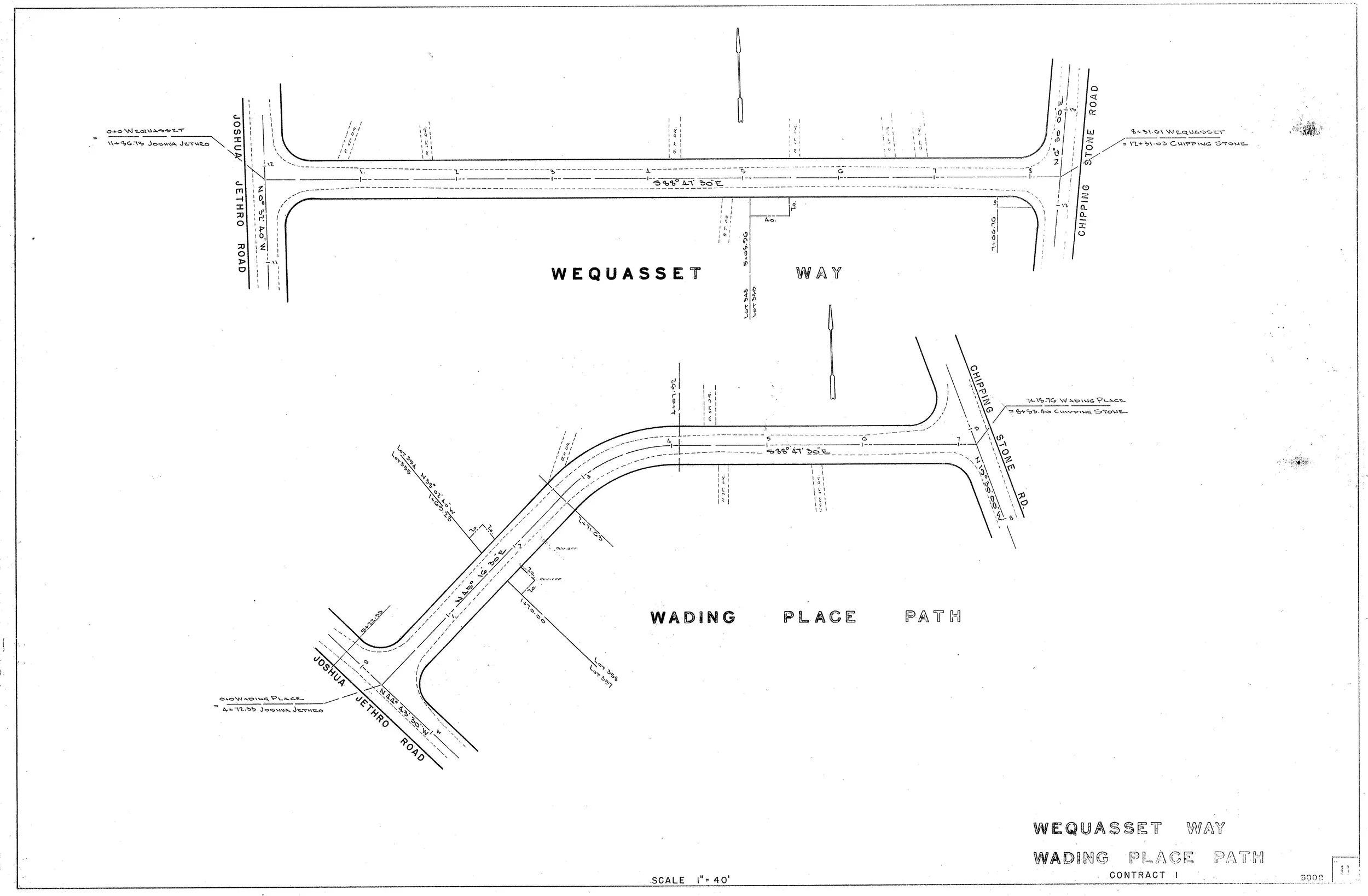
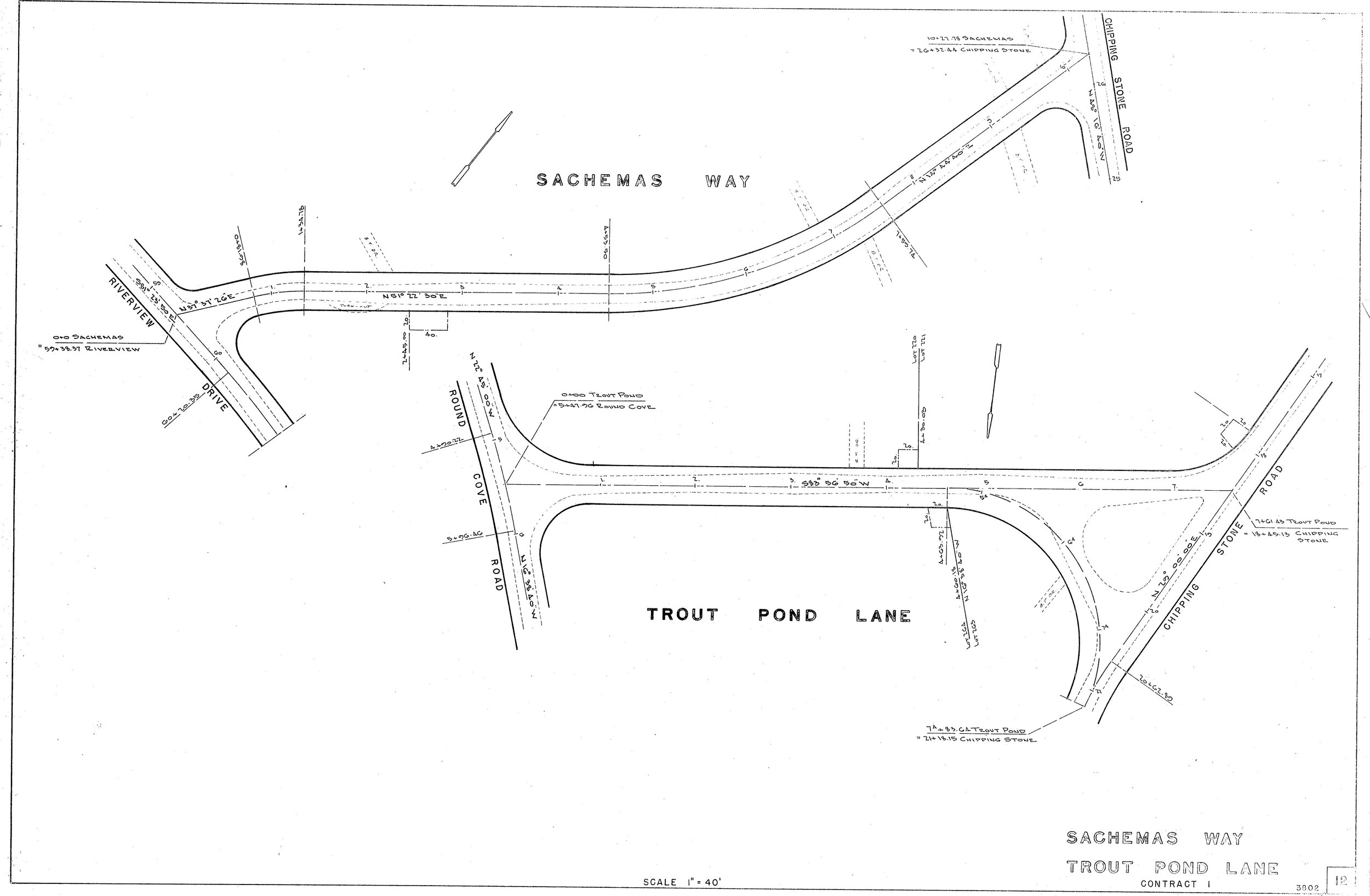
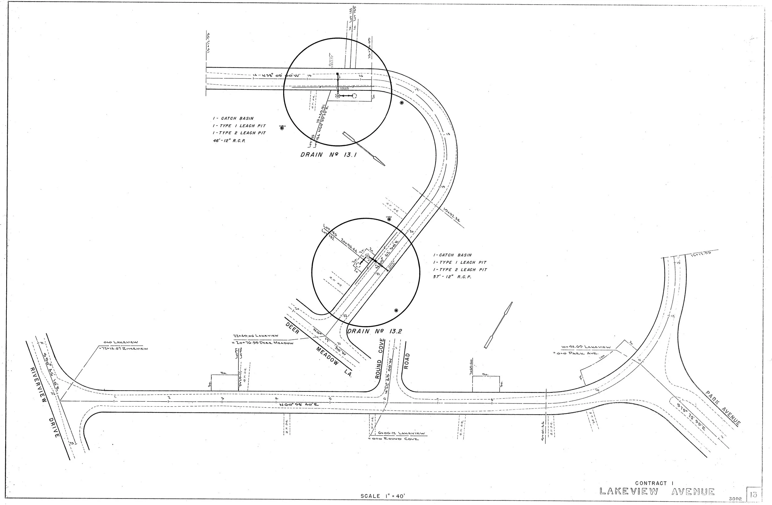
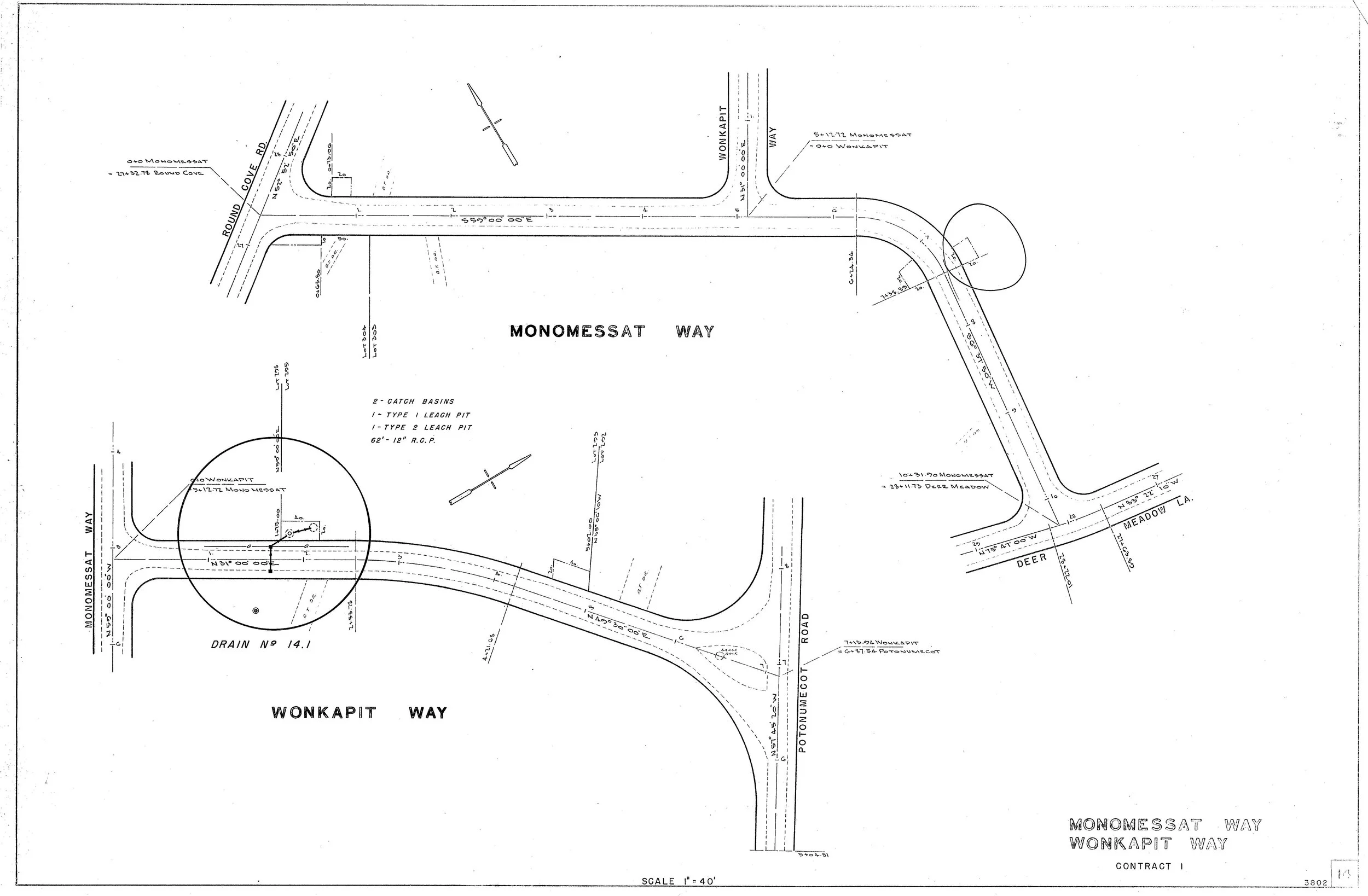
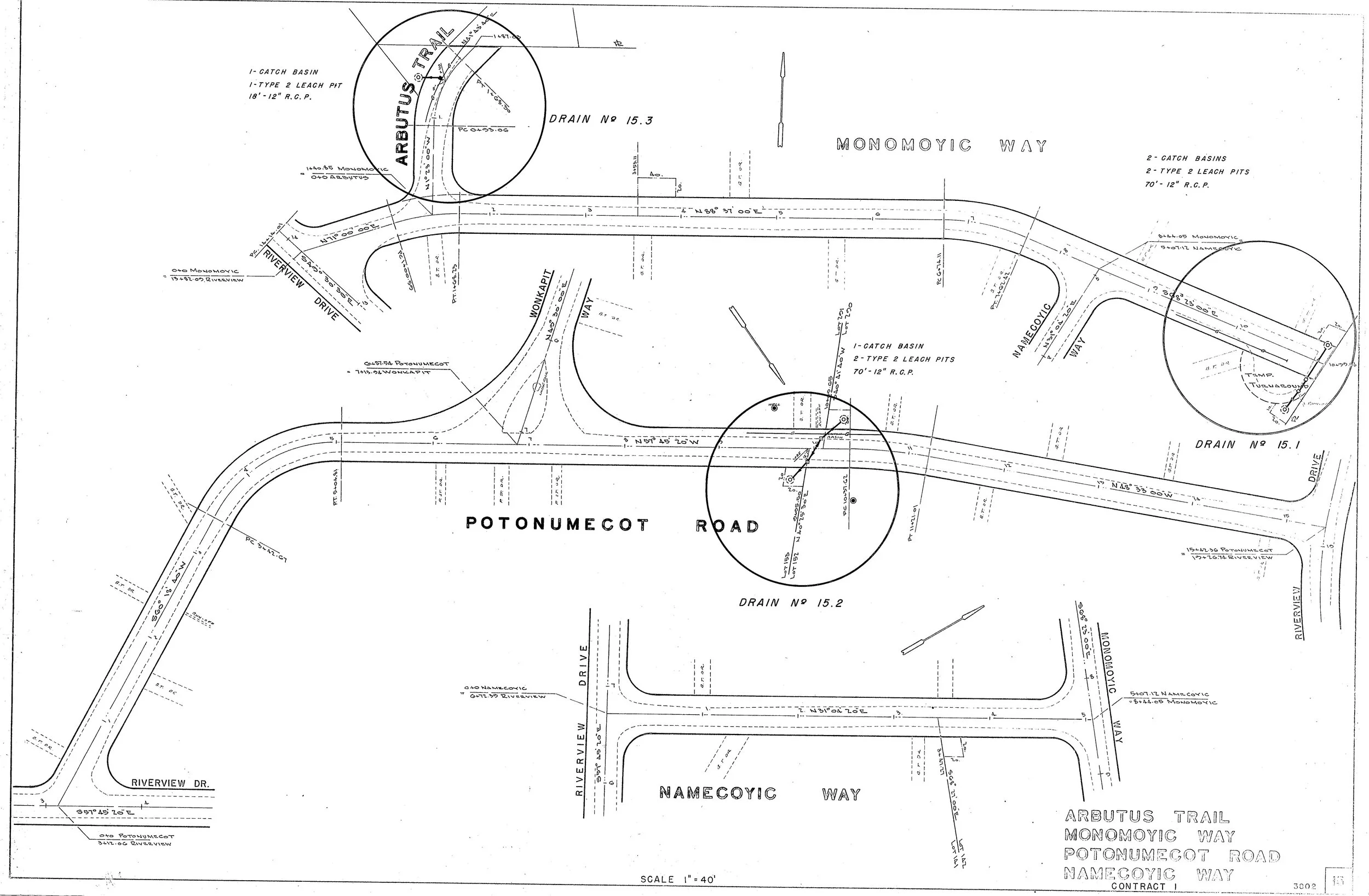
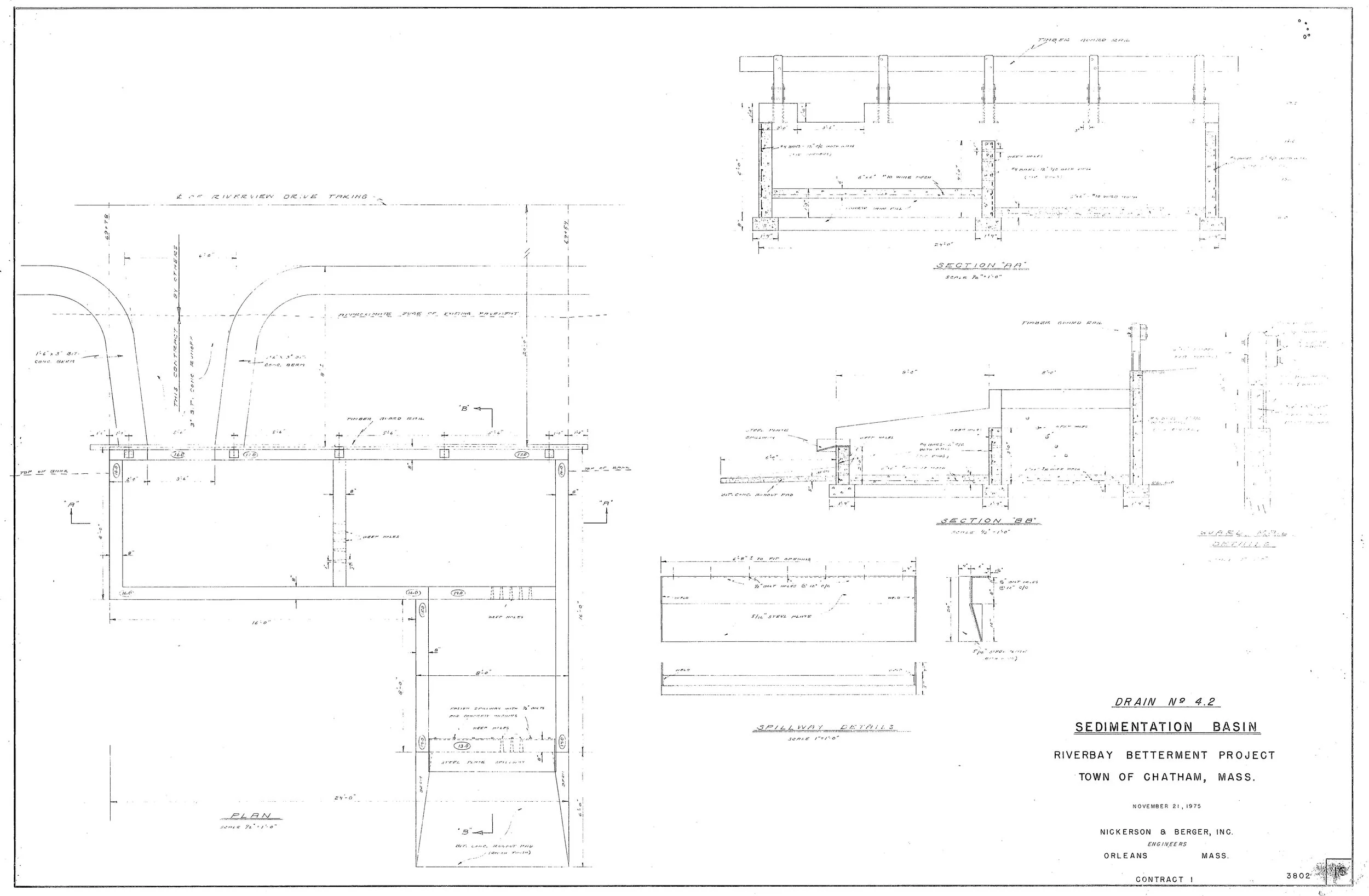
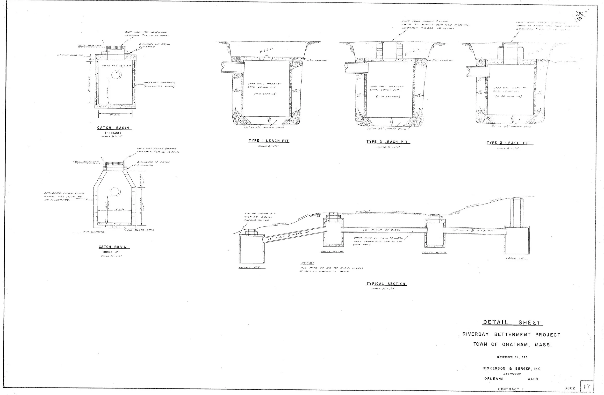
Cover Page.jpg
Sh 00.jpg
Sh 01.jpg
Sh 02.jpg
Sh 03.jpg
Sh 04.jpg
Sh 05.jpg
Sh 06.jpg
Sh 07.jpg
Sh 08.jpg
Sh 09.jpg
Sh 10.jpg
Sh 11.jpg
Sh 12.jpg
Sh 13.jpg
Sh 14.jpg
Sh 15.jpg
Sh 16.jpg
Sh 17.jpg
← 18 Meadow Brook Rd15 School St →