• HOME
    • Chatham
    • HarwichMA
    • Harwich
    • Dennis
    • Brewster
    • Orleans
    • Eastham
    • Wellfleet
    • WellfleetMA
    • Truro
    • Provincetown
    • --------------
    • Yarmouth
    • Barnstable
    • Mashpee
    • Falmouth
    • Sandwich
    • Bourne
    • Gosnold
    • Aquinnah
    • Chilmark
    • Tisbury
    • Edgartown
    • Nantucket
    • Barnstable County
    • North Reading
    • --------------
    • Website Instructions
    • Homepage Instructions
    • drone images
    • Drone Information
    • Drone Services
    • ===Drone Flights===
    • Drone Presentation 3rd Graders
    • Chatham Elementary Shark School
    • MassGIS Aerial Links
    • Mattacheese
    • MRHS Flag Pole
    • Site Photos
    • Pano Tours Testing
    • Zoning Temp
    • EDIT FRONT PAGE
    • Text Output
    • New Page
    • HOMEPAGE 2021
    • Probabilities
    • Handheld LiDAR
    • MADEP DEM Maps
    • SEWER TEST
    • surveyors
    • Panoramadama
    • Orienteering
    • ScannerJammer
    • Architectural Example
    • Sample Files
    • 2022 Septic Revisions
    • Cape Cod Tide Charts
    • Native Plants
    • Presentations
    • Datums Partially Explained
    • Regulations and Law
    • NHESP REPORTING
    • Scientific
    • Contractors
    • Surveyor Stats
    • Seminar Handouts
    • Map Instructions
    • Sewer
    • Merge NEZ
    • RW5 Renamer
    • NavVis Control Converter
    • -----Stable above, Beta below
    • RW5 Crawler
    • Panorama
    • APPS
    • ImageMapper
    • mlx-upload
    • Staff
    • J. Thaddeus Eldredge
    • Terry W. Eldredge
    • Cyndi Penny
    • Dan Croteau
    • Emma S. Eldredge
    • Luka S. Eldredge
    • Marija S. Eldredge
  • CONTACT
Menu

East-SouthEast, LLC

  • HOME
  • BY TOWN
    • Chatham
    • HarwichMA
    • Harwich
    • Dennis
    • Brewster
    • Orleans
    • Eastham
    • Wellfleet
    • WellfleetMA
    • Truro
    • Provincetown
    • --------------
    • Yarmouth
    • Barnstable
    • Mashpee
    • Falmouth
    • Sandwich
    • Bourne
    • Gosnold
    • Aquinnah
    • Chilmark
    • Tisbury
    • Edgartown
    • Nantucket
    • Barnstable County
    • North Reading
    • --------------
    • Website Instructions
    • Homepage Instructions
  • IMAGERY
    • drone images
    • Drone Information
    • Drone Services
    • ===Drone Flights===
    • Drone Presentation 3rd Graders
    • Chatham Elementary Shark School
    • MassGIS Aerial Links
    • Mattacheese
    • MRHS Flag Pole
  • BETA
    • Site Photos
    • Pano Tours Testing
    • Zoning Temp
    • EDIT FRONT PAGE
    • Text Output
    • New Page
    • HOMEPAGE 2021
    • Probabilities
    • Handheld LiDAR
    • MADEP DEM Maps
    • SEWER TEST
    • surveyors
    • Panoramadama
    • Orienteering
  • LiDAR
    • ScannerJammer
    • Architectural Example
    • Sample Files
  • TECHNICAL RESOURCES
    • 2022 Septic Revisions
    • Cape Cod Tide Charts
    • Native Plants
    • Presentations
    • Datums Partially Explained
    • Regulations and Law
    • NHESP REPORTING
    • Scientific
    • Contractors
    • Surveyor Stats
    • Seminar Handouts
    • Map Instructions
    • Sewer
  • APPS
    • Merge NEZ
    • RW5 Renamer
    • NavVis Control Converter
    • -----Stable above, Beta below
    • RW5 Crawler
    • Panorama
    • APPS
    • ImageMapper
    • mlx-upload
  • STAFF
    • Staff
    • J. Thaddeus Eldredge
    • Terry W. Eldredge
    • Cyndi Penny
    • Dan Croteau
    • Emma S. Eldredge
    • Luka S. Eldredge
    • Marija S. Eldredge
  • CONTACT
×

Chapter 91

ESE March 9, 2024

Town of Provincetown webpage regarding Historic Mean High Water

Massachusetts Legislative Bureau, Report on Legal Background of the “Province Lands” 1961

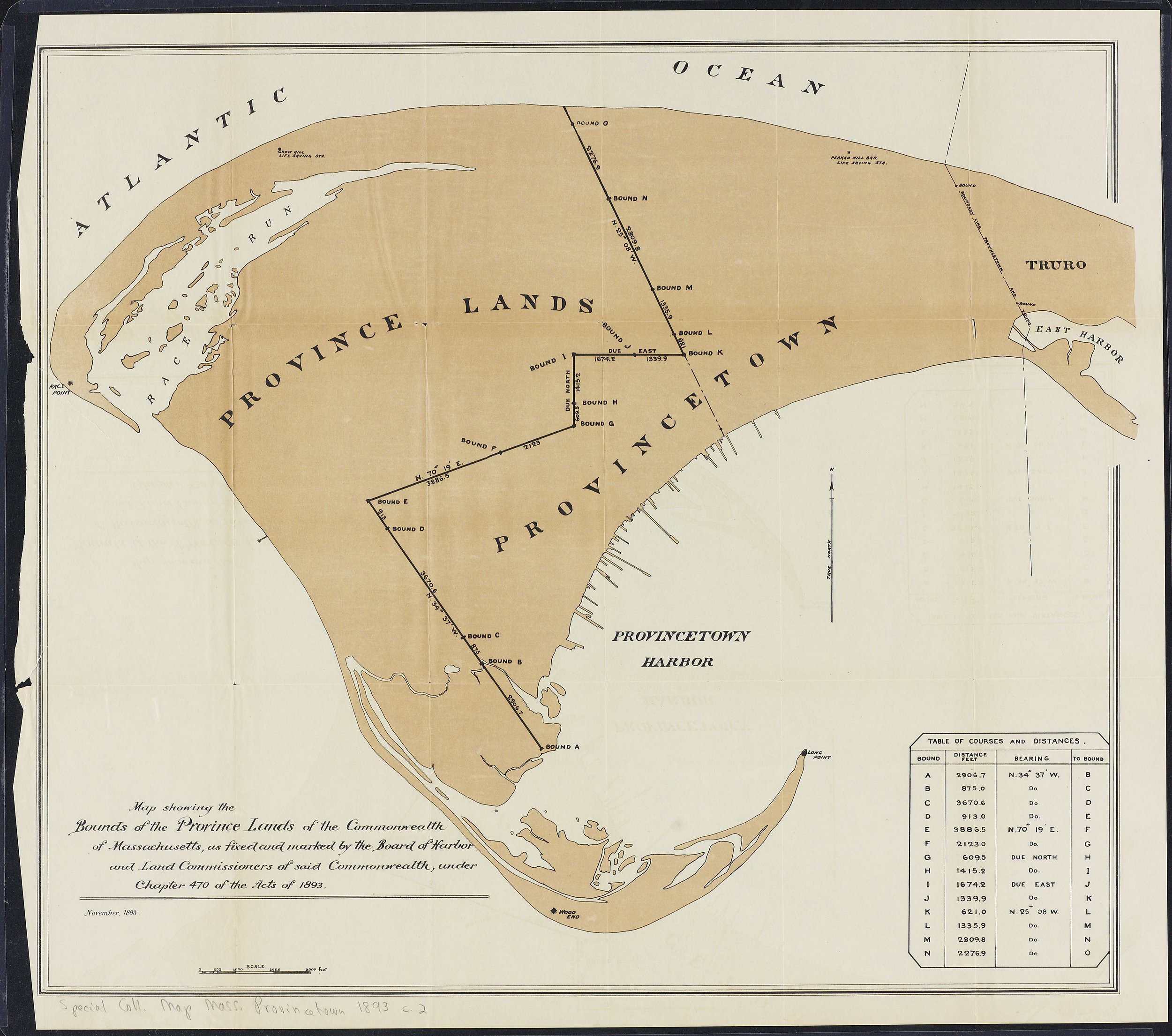
Map of Province Lands

Acts of 1854, Chapter 261

236 Mass 87 Sklaroff v Commonwealth

Acts of 1893, Chapter 470

DEP Page with much information

Lorusso v. Acapesket Improvement Ass'n, 408 Mass. 772 (1990)

Allen v. Wood, 256 Mass. 343 (1926)

Chapter 91

12-2-17-a-foot-pearl-st →

Powered by Squarespace